Open in App
pacer logopacer logomenu

Best Parks Near Blain

Explore the most popular parks in Blain. Whether you are looking for a place to take a walk or run, enjoy a picnic, or have a good time with your kids and dogs, let us help you find the perfect spot. Enjoy the best of Blain parks!

Park amenity
See All
Nature view
See All
Suitability
Sport facility
See All
Showing 10 parks
Filters
Park amenity
See All

Playground

Playground

Restroom

Restroom

Picnic Site

Picnic Site

Drinking water

Drinking water

Parking lot

Parking lot
Nature view
See All

Tree

Tree

Lake

Lake

Grassland

Grassland

River

River

Beach

Beach
Suitability

Wheelchair friendly

Wheelchair friendly

Dog friendly

Dog friendly
Sport facility
See All

Bike path

Bike path

Running track

Running track

Tennis court

Tennis court

Football field

Football field

Soccer field

Soccer field
Hemlocks Natural Area
Hemlocks Natural Area, located in the serene city of Blain, is a haven for walkers and hikers, encompassing 99.4 acres of stunning natural beauty. With its lush hemlock forests and picturesque trails, this park offers an ideal setting for those seeking an immersive outdoor walking or hiking experience. Whether you're an avid hiker or simply enjoy leisurely strolls, the park's diverse terrain and well-maintained trails cater to all activity levels, making it a perfect destination for nature enthusiasts looking to explore the great outdoors. Visitors to Hemlocks Natural Area can embark on an enriching journey through the park's captivating landscapes, immersing themselves in the tranquility of nature while engaging in invigorating physical activity. The park features a variety of scenic routes, including the Patterson Run Trail, which spans 0.7 miles and offers a delightful walking experience. With its moderate rating and positive reviews, this trail provides an opportunity to enjoy the natural splendor of the area while engaging in a fulfilling outdoor activity. Whether you're seeking a brief stroll or a more challenging hike, the park's diverse trails cater to a range of preferences, promising an unforgettable walking or hiking adventure for all who visit. For those eager to discover more about the park's routes and access comprehensive information on walking and hiking activities, consider downloading Pacer Pedometer. This invaluable tool provides detailed insights into the park's routes, allowing you to plan and customize your walking or hiking experiences with ease. Hemlocks Natural Area invites you to embrace the beauty of nature and embark on an enriching journey through its enchanting trails, promising an unforgettable outdoor adventure for walkers and hikers of all levels.
walking in Hemlocks Natural Area map in Blain
Frank E. Masland, Jr. Natural Area
Discover the natural beauty of Frank E. Masland, Jr. Natural Area in Blain, a 1256.0-acre park that offers a variety of walking and hiking trails for outdoor enthusiasts. With a range of routes to explore, from the tranquil Turbot Trail to the scenic North Branch Trail, visitors can enjoy leisurely strolls or challenging hikes through diverse landscapes. Whether you're seeking a peaceful nature walk or an invigorating outdoor activity, this park is the ideal destination for walkers and hikers of all levels. With its well-maintained trails and picturesque surroundings, Frank E. Masland, Jr. Natural Area promises an unforgettable outdoor experience for nature lovers and adventure seekers alike. Immerse yourself in the natural wonders of Frank E. Masland, Jr. Natural Area, where the longest route spans 1.3 miles and the total number of routes offers plenty of options for exploration. The Boiler Trail and Deer Hollow Trail are also popular choices for those looking to engage in outdoor activity, providing diverse terrain and breathtaking views along the way. Whether you're a seasoned hiker or a casual walker, the park's well-marked trails and peaceful atmosphere make it a must-visit destination for anyone seeking an active outdoor adventure. As you embark on your journey through this expansive natural area, you'll be captivated by the beauty of the surroundings and the sense of serenity that comes with every step. For more information about the park and its routes, download Pacer Pedometer, an essential tool for accessing detailed park and route info. Whether you're planning a solo walk or a group hiking excursion, Frank E. Masland, Jr. Natural Area invites you to experience the joy of outdoor activity amidst stunning natural landscapes. Come and explore the trails, breathe in the fresh air, and revel in the beauty of nature as you embark on a memorable walking or hiking adventure in this captivating park.
walking in Frank E. Masland, Jr. Natural Area map in Blain
Big Spring State Park
Experience the natural beauty and tranquility of Big Spring State Park, located in the charming city of Blain. This 44.5-acre park offers a serene ambiance and picturesque landscapes, making it an ideal destination for walkers and hikers seeking a peaceful retreat. The park's lush greenery and refreshing springs create an inviting atmosphere for outdoor enthusiasts to explore and enjoy the beauty of nature. Visitors to Big Spring State Park can engage in a variety of activities, including walking, hiking, and picnicking. The park's trails cater to all skill levels, providing opportunities for leisurely strolls as well as challenging hikes. The typical climate of Blain offers pleasant conditions for outdoor activities, with mild temperatures and beautiful scenery year-round, making it an excellent destination for walkers and hikers to indulge in their favorite outdoor pursuits. Don't miss the chance to immerse yourself in the natural wonders of Big Spring State Park. Whether you're seeking a leisurely stroll or a more rigorous hike, this park offers something for everyone. Plan your visit today and discover the beauty and tranquility of this hidden gem. For more information about park routes and walking/hiking activities, download the Pacer Pedometer app and explore the wealth of outdoor experiences waiting for you at Big Spring State Park.
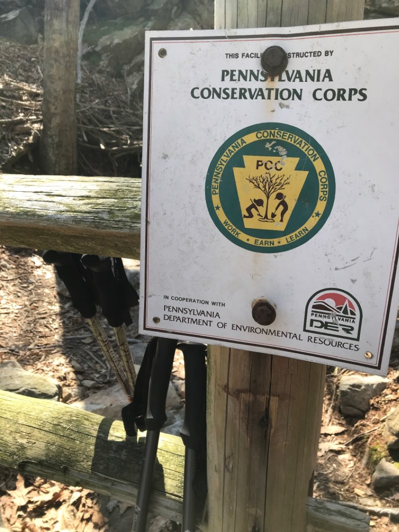
walking near me in Big Spring State Park in spring
Fowlers Hollow State Park
Located in Blain, Fowlers Hollow State Park is a haven for walkers and hikers, offering 101.0 acres of scenic natural beauty to explore. With a variety of well-maintained trails, this park provides the ideal setting for outdoor enthusiasts to indulge in their passion for walking and hiking. Whether you're seeking a leisurely stroll or a more challenging trek, Fowlers Hollow State Park has routes suited to all levels of activity, making it an ideal destination for those who seek an invigorating outdoor experience. Visitors to Fowlers Hollow State Park can choose from a range of picturesque routes, including the popular Fowler Hollow Trail, which spans 1.2 miles, and the scenic Hart Ridge Trail, measuring 0.9 miles in length. These well-marked trails offer the opportunity to immerse oneself in the park's natural wonders while enjoying a satisfying outdoor workout. The park's diverse trail options cater to both casual walkers and avid hikers, ensuring that there is something for everyone to enjoy amidst the tranquil surroundings of Fowlers Hollow State Park. For walkers and hikers seeking an escape into nature, Fowlers Hollow State Park in Blain, United States, promises a rewarding outdoor experience. With its range of well-maintained trails and 101.0 acres of breathtaking scenery, this park provides an ideal setting for outdoor activity enthusiasts. Whether you're looking for a peaceful stroll or a more challenging hike, Fowlers Hollow State Park offers routes suited to all levels of activity. For more information about parks and route details, visitors can download Pacer Pedometer to further enhance their exploration of Fowlers Hollow State Park and other outdoor destinations.
walking in Fowlers Hollow State Park map in Blain
State Game Lands Number 169
Immerse yourself in the serene beauty of State Game Lands Number 169 in Newville. Spanning 2513.3 acres, this park offers a tranquil ambiance that is ideal for walkers and hikers seeking a peaceful escape in nature. With its diverse landscapes and picturesque trails, this park provides the perfect setting for a rejuvenating outdoor adventure. Visitors to State Game Lands Number 169 can enjoy a variety of activities, including walking and hiking along well-maintained trails that showcase the natural splendor of the area. Newville experiences a temperate climate, making it an excellent destination for year-round outdoor pursuits. Whether you prefer a leisurely stroll or a challenging hike, this park has something to offer for all levels of outdoor enthusiasts. Experience the beauty and tranquility of State Game Lands Number 169 in Newville. Whether you're an avid hiker or simply enjoy a leisurely walk in nature, this park welcomes you to explore its natural wonders. Plan your visit today and discover the scenic trails and abundant wildlife that await. For more information on parks and routes, download Pacer Pedometer to enhance your outdoor experience.
walking in State Game Lands Number 169 map in Newville
Colonel Denning State Park
Beach
Explore the natural beauty of Colonel Denning State Park in Newville, United States, covering 299.3 acres of picturesque landscapes and diverse hiking trails. Whether you're an avid hiker seeking a challenging adventure or a leisurely walker in search of tranquil surroundings, this park offers an array of options to suit your activity level. With well-maintained trails and stunning vistas, Colonel Denning State Park is the perfect destination for outdoor enthusiasts looking to immerse themselves in the beauty of nature while engaging in invigorating walking and hiking activities. Colonel Denning State Park features a variety of hiking routes, including the popular Flat Rock Trail, which offers a captivating 2.3-mile hike with an estimated time of 39 minutes, and the scenic 1.4-mile Flat Rock Trail, providing a shorter yet equally rewarding adventure. Whether you're in search of a brisk walk or a longer, more challenging hike, the park's multiple routes cater to a range of preferences and fitness levels. Immerse yourself in the park's lush woodlands, tranquil streams, and breathtaking views, making every step a delightful experience. For walkers and hikers eager to embark on an enriching outdoor excursion, Colonel Denning State Park is the ideal destination to explore the wonders of nature. Whether you're seeking a peaceful stroll or a vigorous hike, the park's diverse terrain and well-marked trails offer endless opportunities for adventure and discovery. Embrace the serenity of the park's natural surroundings, breathe in the fresh air, and relish the sense of accomplishment as you navigate through captivating landscapes. For more information about the park's routes and trail options, users can download the Pacer Pedometer app to access detailed park and route information to enhance their outdoor experiences.
walking in Colonel Denning State Park map in Newville
State Game Lands Number 215
Discover the natural beauty of State Game Lands Number 215 in Honey Grove, a serene and captivating destination for walkers and hikers. Spread across 1285.8 acres, this park offers a tranquil ambiance with picturesque trails and diverse wildlife, making it an ideal retreat for outdoor enthusiasts seeking an immersive nature experience. In State Game Lands Number 215, visitors can indulge in a range of activities, including walking, hiking, and wildlife observation. With a typical climate that boasts mild temperatures and pleasant conditions for outdoor pursuits, this park provides an inviting environment for year-round exploration. Whether you're seeking a leisurely stroll or a challenging hike, the park's varied terrain caters to all levels of outdoor activity enthusiasts. Plan your next outdoor adventure at State Game Lands Number 215 and immerse yourself in the tranquility of nature. From the captivating scenery to the diverse wildlife, this park offers an enriching experience for walkers and hikers of all ages. For more information about parks and route info, download Pacer Pedometer and embark on a journey of exploration and discovery.
walking in State Game Lands Number 215 map in Honey Grove
Tuscarora State Forest
star
star
star
star
star
7
Spring · Wetland
Tuscarora State Forest in Honey Grove offers a picturesque and serene setting for walkers and hikers to explore. With a vast expanse of 95990.9 acres, this park provides an ideal environment for outdoor activity enthusiasts. The park boasts an extensive network of trails, including the popular Tuscarora Trail, which spans 10.7 miles and offers a rewarding experience for those seeking a moderate challenge. Whether you're looking for a leisurely stroll or a more challenging hike, this forest has something to offer for all levels of experience and fitness. Visitors to Tuscarora State Forest in Honey Grove can immerse themselves in the natural beauty of the landscape while enjoying a variety of walking and hiking routes. The park's well-maintained trails cater to different preferences, from shorter scenic walks to longer, more invigorating hikes. The Tuscarora Trail, with its 4.0 rating and one review, stands as a testament to the rewarding experiences that await hikers. With its 95990.9 acres of diverse terrain, this park provides an excellent opportunity for walkers and hikers to engage with nature and stay active. For walkers and hikers looking to explore the beauty of Tuscarora State Forest in Honey Grove, the park's trails and routes offer an invigorating outdoor experience. Whether you're a seasoned hiker or just starting out, the park's varied landscapes and well-marked trails provide an excellent opportunity to enjoy the great outdoors. For more information about the park and its routes, users can download Pacer Pedometer, an app that offers comprehensive details about parks and routes to enhance their walking and hiking experiences.
walking near me in Tuscarora State Forest in spring
Tuscarora Valley Heritage Days
Discover the serene beauty of Tuscarora Valley Heritage Days in East Waterford, a 40-acre park nestled in the heart of the city. This picturesque park offers a tranquil and scenic environment, making it an ideal destination for walkers and runners seeking a peaceful retreat. With its winding trails and lush greenery, this park provides the perfect setting for outdoor enthusiasts to immerse themselves in nature while enjoying invigorating walks and runs. Visitors to Tuscarora Valley Heritage Days can partake in a variety of activities, including walking, running, and hiking along the well-maintained trails. Whether strolling through the park's woodlands or tackling more challenging terrains, outdoor enthusiasts can experience the changing seasons and typical climates of East Waterford while engaging in their preferred physical activities. The park's diverse landscapes offer opportunities for walkers and runners of all skill levels to explore and enjoy. Experience the tranquility and natural beauty of Tuscarora Valley Heritage Days in East Waterford. Whether you seek a leisurely stroll or an energizing run, this park provides the ideal setting for outdoor activities amidst stunning surroundings. Don't miss the chance to explore this hidden gem in the heart of the city. For more information about the park and its routes, download Pacer Pedometer and embark on a rewarding outdoor adventure.
walking in Tuscarora Valley Heritage Days map in East Waterford
Lurgan Township Recreation Center
Welcome to the Lurgan Township Recreation Center in Orrstown, a charming 29.2-acre park offering a serene and picturesque setting for walkers and runners. The park's lush greenery and well-maintained trails create a peaceful ambiance that is ideal for those seeking an escape from the hustle and bustle of city life. Whether you prefer a leisurely stroll or an invigorating run, this park provides the perfect backdrop for outdoor activity enthusiasts. Visitors to the Lurgan Township Recreation Center can engage in a variety of activities, including walking, running, and hiking along the scenic trails that wind through the park. The temperate climate of Orrstown lends itself to year-round outdoor enjoyment, with mild winters and pleasant summers. Whether you're looking for a brisk morning walk or a challenging hike, this park offers diverse terrain and natural beauty for all levels of outdoor enthusiasts. We invite you to experience the natural splendor and recreational opportunities at the Lurgan Township Recreation Center. Whether you're a local resident or a visitor to Orrstown, this park welcomes you to explore its tranquil surroundings and invigorating trails. Don't miss the chance to discover the beauty of this hidden gem in Orrstown. For more information about park facilities and walking routes, download the Pacer Pedometer app and start your adventure today!
walking in Lurgan Township Recreation Center map in Roxbury
Last updated: Dec 21, 2024
pacer

Pacer Walking App

Pacer is the best walking app for walking challenges and finding places to walk near me.