Pacer Walking App
The #1 Walking App
4.8
(1643K)
Open in App
Walking App
Near Me
Clubs
Challenges
Medals
For Workplaces
© Mapbox
© OpenStreetMap
Improve this map
© Mapbox
© OpenStreetMap
Improve this map
Routes
Santiago Province
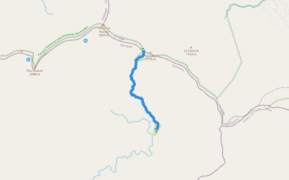
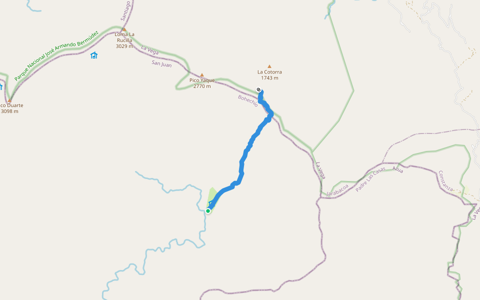
Bao Valley - Lilís Valley (11.8 Km)
Santiago Province
Santiago Province
Bao Valley - Lilís Valley (11.8 Km)
1
reviews
Length
4.7 mi
Elev. Gain
419.8 ft
Est. Steps
11000
Bao Valley - Lilís Valley (11.8 Km) Introduction
Bao Valley - Lilís Valley (11.8 Km) is a 4.8 mile (11,000-step) route located near Santiago Province. This route has an elevation gain of about 419.8 ft and is rated as medium. Find the best walking trails near you in Pacer App.
Open in App for Details
Map of Bao Valley - Lilís Valley (11.8 Km)
© Mapbox © OpenStreetMap
View Full Map
View Full Map
Last updated: Mar 1, 2025
Route Details
Length
4.7 mi
Elev. Gain
419.8 ft
Est. Steps
11000
Recommended Routes Near Bao Valley - Lilís Valley (11.8 Km)
Santiago Province
Valle de Lilís - Pico Duarte (1,2 km)
Length 0.6 mi
· Elev 301.8 ft
San Juan
La Compartión - Lilís Valley (3.8 km)
Length 2.2 mi
· Elev 1554.7 ft
San Juan
Agüita Fría - La Compartión (4 km)
Length 2.9 mi
· Elev 275.5 ft
Montazo, San Juan
Ninja Shortcut
Length 4.2 mi
Montazo, San Juan
El Cruce -Tetero Valley (8 Km)
Length 3.8 mi
· Elev 1859.8 ft
La Vega
El Cruce - Agüita Fría (3 km)
Length 2 mi
· Elev 1758.1 ft
Pacer Walking App
Pacer is the
best walking app
for walking challenges and finding
places to walk near me
.
Open in App for Details
Cancel
Yes
Pacer Walking App
The #1 Walking App
4.8
(1643K)
Open in App
Walking App
Near Me
Walking Clubs
Walking Challenges
Medals
For Workplaces