Pacer Walking App
The #1 Walking App
4.8
(1643K)
Open in App
Walking App
Near Me
Clubs
Challenges
Medals
For Workplaces
© Mapbox
© OpenStreetMap
Improve this map
© Mapbox
© OpenStreetMap
Improve this map
France
Auvergne-Rhône-Alpes
Clermont-Ferrand
Middle Coast Path
Clermont-Ferrand, Auvergne-Rhône-Alpes
France
Auvergne-Rhône-Alpes
Clermont-Ferrand
Middle Coast Path
1
reviews
Length
0.3 mi
Est. Steps
500
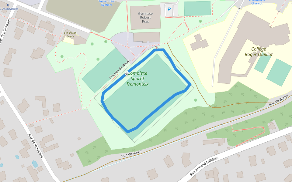
Middle Coast Path Introduction
Middle Coast Path is a 0.3 mile (500-step) route located near Clermont-Ferrand, Auvergne-Rhône-Alpes. This route has an elevation gain of about 0 ft and is rated as easy. Find the best walking trails near you in Pacer App.
Open in App for Details
Map of Middle Coast Path
© Mapbox © OpenStreetMap
View Full Map
View Full Map
Last updated: Apr 1, 2025
Route Details
Length
0.3 mi
Est. Steps
500
Recommended Routes Near Middle Coast Path
Clermont-Ferrand, Auvergne-Rhône-Alpes
Haut des Côtes Trail
Length 0.2 mi
Clermont-Ferrand, Puy-de-Dôme, France
Puy de la Mouchette - Chemin de la Plaine
Length 3.8 mi
· Elev 721.6 ft
Clermont-Ferrand, Auvergne-Rhône-Alpes
Bouys Road
Length 0.2 mi
Clermont-Ferrand, Auvergne-Rhône-Alpes
Robert Pras Gymnasium
Length 0.2 mi
Clermont-Ferrand, Puy-de-Dôme, France
Sagottiers path
Length 1.2 mi
· Elev 269 ft
Clermont-Ferrand, Puy-de-Dôme, France
La Glaciere - Chemin des Lauriers
Length 1.8 mi
· Elev 298.5 ft
Pacer Walking App
Pacer is the
best walking app
for walking challenges and finding
places to walk near me
.
Open in App for Details
Cancel
Yes
Pacer Walking App
The #1 Walking App
4.8
(1643K)
Open in App
Walking App
Near Me
Walking Clubs
Walking Challenges
Medals
For Workplaces