Pacer Walking App
The #1 Walking App
4.8
(1643K)
Open in App
Walking App
Near Me
Clubs
Challenges
Medals
For Workplaces
© Mapbox
© OpenStreetMap
Improve this map
© Mapbox
© OpenStreetMap
Improve this map
Canada
Ontario
Richmond Hill
Macleod's Landing
Richmond Hill, Ontario
Canada
Ontario
Richmond Hill
Macleod's Landing
1
reviews
Length
1.6 mi
Elev. Gain
42.6 ft
Est. Steps
4000
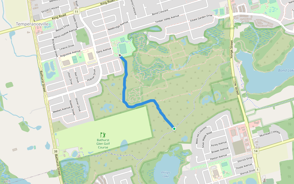
Macleod's Landing Introduction
Macleod's Landing is a 1.6 mile (4,000-step) route located near Richmond Hill, Ontario. This route has an elevation gain of about 42.6 ft and is rated as easy. Find the best walking trails near you in Pacer App.
Open in App for Details
Map of Macleod's Landing
© Mapbox © OpenStreetMap
View Full Map
View Full Map
Last updated: Mar 1, 2025
Route Details
Length
1.6 mi
Elev. Gain
42.6 ft
Est. Steps
4000
Recommended Routes Near Macleod's Landing
Richmond Hill, Ontario
Bond Lake Loop
Length 1.4 mi
· Elev 9.8 ft
Richmond Hill, Ontario, Canada
Bond Lake
Length 1.8 mi
Richmond Hill, Ontario
Snowy Meadow Trail
Length 0.4 mi
· Elev 9.8 ft
Richmond Hill, Ontario
Grovewood Park Section
Length 0.8 mi
· Elev 9.8 ft
Richmond Hill, Ontario
Kingshill Access
Length 0.2 mi
Richmond Hill, Ontario
Jefferson SideRd Section
Length 0.5 mi
· Elev 13.1 ft
Pacer Walking App
Pacer is the
best walking app
for walking challenges and finding
places to walk near me
.
Open in App for Details
Cancel
Yes
Pacer Walking App
The #1 Walking App
4.8
(1643K)
Open in App
Walking App
Near Me
Walking Clubs
Walking Challenges
Medals
For Workplaces