Pacer Walking App
The #1 Walking App
4.8
(1643K)
Open in App
Walking App
Near Me
Clubs
Challenges
Medals
For Workplaces
© Mapbox
© OpenStreetMap
Improve this map
© Mapbox
© OpenStreetMap
Improve this map
Australia
New South Wales
Waterfall
Westmacott Walking Track
Waterfall, New South Wales
Australia
New South Wales
Waterfall
Westmacott Walking Track
1
reviews
Length
0.3 mi
Elev. Gain
137.8 ft
Est. Steps
500
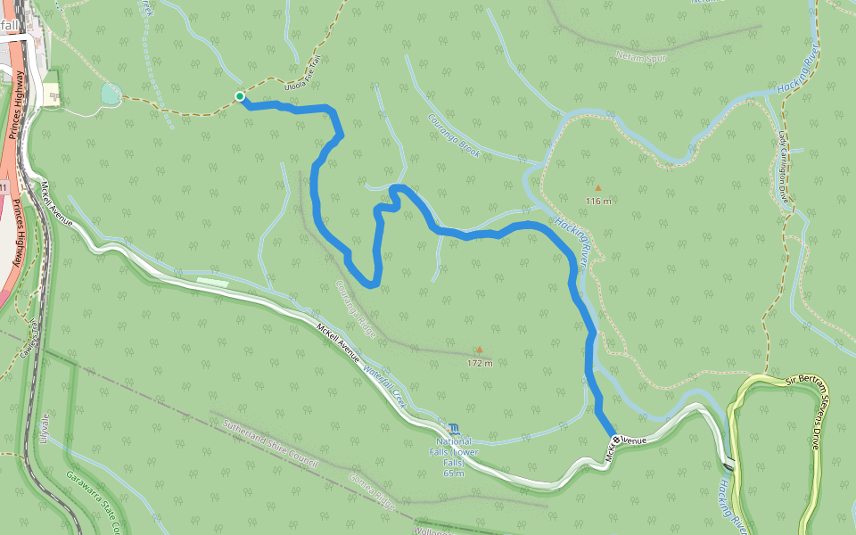
Westmacott Walking Track Introduction
Westmacott Walking Track is a 0.3 mile (500-step) route located near Waterfall, New South Wales. This route has an elevation gain of about 137.8 ft and is rated as hard. Find the best walking trails near you in Pacer App.
Open in App for Details
Map of Westmacott Walking Track
© Mapbox © OpenStreetMap
View Full Map
View Full Map
Last updated: Apr 1, 2025
Route Details
Length
0.3 mi
Elev. Gain
137.8 ft
Est. Steps
500
Recommended Routes Near Westmacott Walking Track
Waterfall, New South Wales
Camp Coutts Track
Length 0.4 mi
· Elev 9.8 ft
Waterfall, New South Wales
McKell Avenue
Length 0.2 mi
Waterfall, New South Wales
Warabin Street
Length 0.1 mi
Waterfall, New South Wales
Uloola Falls Trail
Length 0.3 mi
Royal National Park, New South Wales
Kangaroo Creek Track
Length 4 mi
Royal National Park, New South Wales
Couranga Track
Length 2.3 mi
Nearby Parks
Heathcote National Park
Pacer Walking App
Pacer is the
best walking app
for walking challenges and finding
places to walk near me
.
Open in App for Details
Cancel
Yes
Pacer Walking App
The #1 Walking App
4.8
(1643K)
Open in App
Walking App
Near Me
Walking Clubs
Walking Challenges
Medals
For Workplaces