Pacer Walking App
The #1 Walking App
4.8
(1643K)
Open in App
Walking App
Near Me
Clubs
Challenges
Medals
For Workplaces
© Mapbox
© OpenStreetMap
Improve this map
© Mapbox
© OpenStreetMap
Improve this map
Routes
England
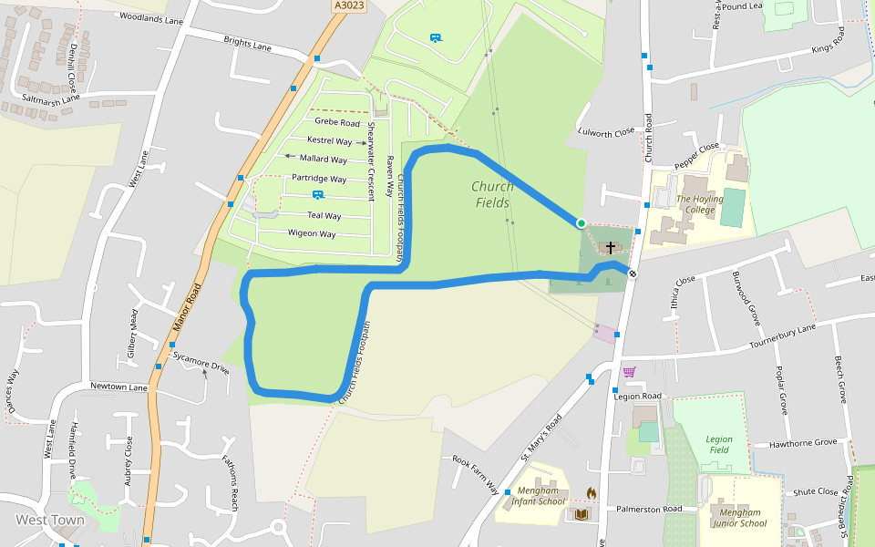
Church Fields Footpath
England
England
Church Fields Footpath
1
reviews
Length
1.1 mi
Elev. Gain
3.3 ft
Est. Steps
2500
Church Fields Footpath Introduction
Church Fields Footpath is a 1.1 mile (2,500-step) route located near England. This route has an elevation gain of about 3.3 ft and is rated as easy. Find the best walking trails near you in Pacer App.
Open in App for Details
Map of Church Fields Footpath
© Mapbox © OpenStreetMap
View Full Map
View Full Map
Last updated: Mar 1, 2025
Route Details
Length
1.1 mi
Elev. Gain
3.3 ft
Est. Steps
2500
Recommended Routes Near Church Fields Footpath
England
Footpath from Church fields to Southleigh Grove
Length 0.1 mi
England
Sandy Point Nature Reserve
Length 1.7 mi
England
Sandy Point Nature Reserve
Length 2.4 mi
England
Wadeway
Length 0.1 mi
Portsmouth, England
Langstone Harbour Waterside Route
Length 14.4 mi
· Elev 65.6 ft
England
Chichester Harbour
Length 1.8 mi
Pacer Walking App
Pacer is the
best walking app
for walking challenges and finding
places to walk near me
.
Open in App for Details
Cancel
Yes
Pacer Walking App
The #1 Walking App
4.8
(1643K)
Open in App
Walking App
Near Me
Walking Clubs
Walking Challenges
Medals
For Workplaces