Pacer Walking App
The #1 Walking App
4.8
(1643K)
Open in App
Walking App
Near Me
Clubs
Challenges
Medals
For Workplaces
© Mapbox
© OpenStreetMap
Improve this map
© Mapbox
© OpenStreetMap
Improve this map
United States
Texas
Sugar Land
Buddy's Trail
Sugar Land, Texas
United States
Texas
Sugar Land
Buddy's Trail
1
reviews
Length
0.8 mi
Elev. Gain
13.1 ft
Est. Steps
1500
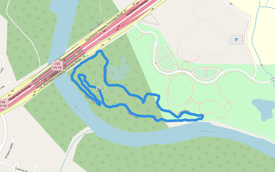
Buddy's Trail Introduction
Buddy's Trail is a 0.8 mile (1,500-step) route located near Sugar Land, Texas. This route has an elevation gain of about 13.1 ft and is rated as easy. Find the best walking trails near you in Pacer App.
Open in App for Details
Map of Buddy's Trail
© Mapbox © OpenStreetMap
View Full Map
View Full Map
Last updated: Mar 1, 2025
Route Details
Length
0.8 mi
Elev. Gain
13.1 ft
Est. Steps
1500
Recommended Routes Near Buddy's Trail
Sugar Land, Texas
Da Bowl
Length 0.2 mi
Sugar Land, Texas, USA
Greatwood Lake
Length 3.9 mi
Sugar Land, Texas
Barbed Wire
Length 1.5 mi
Sugar Land, Texas
Bend Arms
Length 0.5 mi
Sugar Land, Texas
The Wallow Trail
Length 0.9 mi
· Elev 45.9 ft
Sugar Land, Texas
Tower Loop
Length 2 mi
· Elev 19.7 ft
Pacer Walking App
Pacer is the
best walking app
for walking challenges and finding
places to walk near me
.
Open in App for Details
Cancel
Yes
Pacer Walking App
The #1 Walking App
4.8
(1643K)
Open in App
Walking App
Near Me
Walking Clubs
Walking Challenges
Medals
For Workplaces