Pacer Walking App
The #1 Walking App
4.8
(1643K)
Open in App
Walking App
Near Me
Clubs
Challenges
Medals
For Workplaces
© Mapbox
© OpenStreetMap
Improve this map
© Mapbox
© OpenStreetMap
Improve this map
France
Occitanie
Malons-et-Elze
Chemin des Vans at La Rouvière
Malons-et-Elze, Occitanie
France
Occitanie
Malons-et-Elze
Chemin des Vans at La Rouvière
1
reviews
Length
0.3 mi
Elev. Gain
183.7 ft
Est. Steps
500
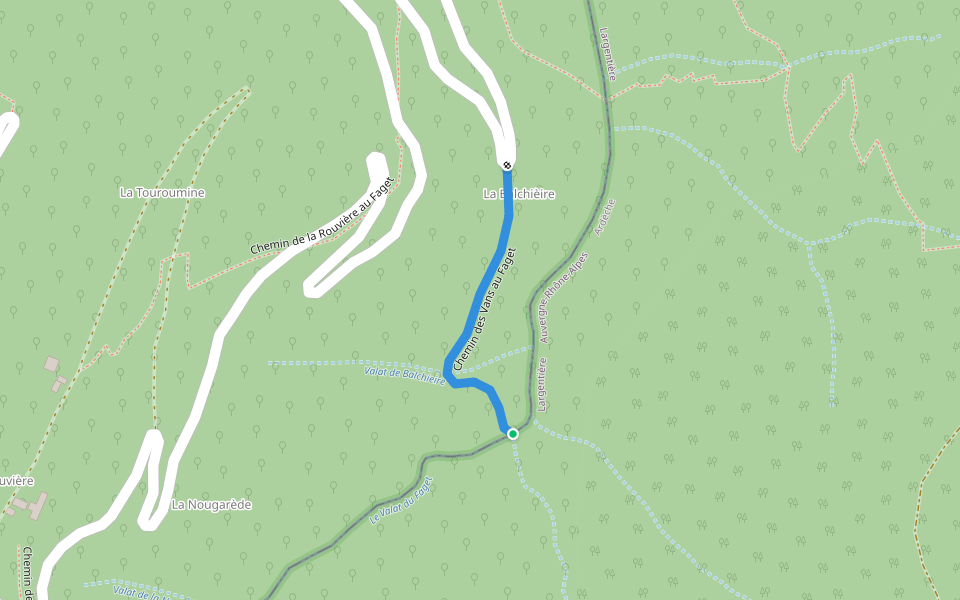
Chemin des Vans at La Rouvière Introduction
Chemin des Vans at La Rouvière is a 0.3 mile (500-step) route located near Malons-et-Elze, Occitanie. This route has an elevation gain of about 183.7 ft and is rated as hard. Find the best walking trails near you in Pacer App.
Open in App for Details
Map of Chemin des Vans at La Rouvière
© Mapbox © OpenStreetMap
View Full Map
View Full Map
Last updated: Apr 1, 2025
Route Details
Length
0.3 mi
Elev. Gain
183.7 ft
Est. Steps
500
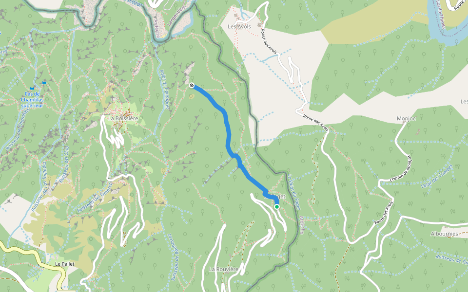
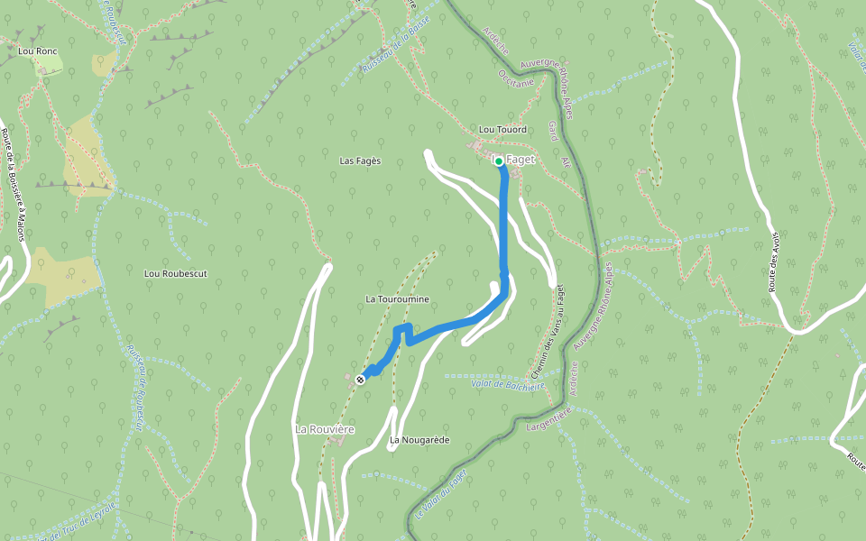
Recommended Routes Near Chemin des Vans at La Rouvière
Malons-et-Elze, Occitanie
Path of Vans to Faget
Length 0.2 mi
Malons-et-Elze, Occitanie
Path from Faget to Boissière
Length 0.7 mi
· Elev 75.4 ft
Malons-et-Elze, Occitanie
Chemin de la Rouvière at Faget
Length 0.4 mi
· Elev 226.3 ft
Malons-et-Elze, Occitanie
Path from Faget to Avols
Length 0.1 mi
Malons-et-Elze, Occitanie
Path from Faget to Figère
Length 0.8 mi
· Elev 108.2 ft
Malons-et-Elze, Occitanie
Serre des Fages path
Length 0.4 mi
Pacer Walking App
Pacer is the
best walking app
for walking challenges and finding
places to walk near me
.
Open in App for Details
Cancel
Yes
Pacer Walking App
The #1 Walking App
4.8
(1643K)
Open in App
Walking App
Near Me
Walking Clubs
Walking Challenges
Medals
For Workplaces