Pacer Walking App
The #1 Walking App
4.8
(1643K)
Open in App
Walking App
Near Me
Clubs
Challenges
Medals
For Workplaces
© Mapbox
© OpenStreetMap
Improve this map
© Mapbox
© OpenStreetMap
Improve this map
France
Hauts-de-France
Villers-Cotterêts
Laie de Magenta
Villers-Cotterêts, Hauts-de-France
France
Hauts-de-France
Villers-Cotterêts
Laie de Magenta
1
reviews
Length
1.2 mi
Elev. Gain
32.8 ft
Est. Steps
2500
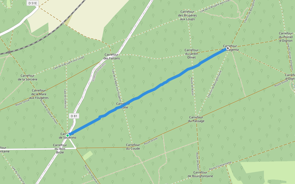
Laie de Magenta Introduction
Laie de Magenta is a 1.2 mile (2,500-step) route located near Villers-Cotterêts, Hauts-de-France. This route has an elevation gain of about 32.8 ft and is rated as easy. Find the best walking trails near you in Pacer App.
Open in App for Details
Map of Laie de Magenta
© Mapbox © OpenStreetMap
View Full Map
View Full Map
Last updated: Mar 1, 2025
Route Details
Length
1.2 mi
Elev. Gain
32.8 ft
Est. Steps
2500
Recommended Routes Near Laie de Magenta
Villers-Cotterêts, Hauts-de-France
Little Marais Sow
Length 1 mi
Coyolles, Hauts-de-France
Laie de la Bruyère aux Loups
Length 0.3 mi
Villers-Cotterêts, Hauts-de-France
Virlet Road
Length 0.5 mi
Coyolles, Hauts-de-France
Bouronne road
Length 1 mi
· Elev 45.9 ft
Coyolles, Hauts-de-France
Sow of Braises
Length 0.7 mi
· Elev 3.3 ft
Coyolles, Hauts-de-France
Laie du Haut-Perrier
Length 0.4 mi
Pacer Walking App
Pacer is the
best walking app
for walking challenges and finding
places to walk near me
.
Open in App for Details
Cancel
Yes
Pacer Walking App
The #1 Walking App
4.8
(1643K)
Open in App
Walking App
Near Me
Walking Clubs
Walking Challenges
Medals
For Workplaces