Pacer Walking App
The #1 Walking App
4.8
(1643K)
Open in App
Walking App
Near Me
Clubs
Challenges
Medals
For Workplaces
© Mapbox
© OpenStreetMap
Improve this map
© Mapbox
© OpenStreetMap
Improve this map
United States
California
Berkeley
Summit House Trail
Berkeley, California
United States
California
Berkeley
Summit House Trail
1
reviews
Length
0.3 mi
Est. Steps
500
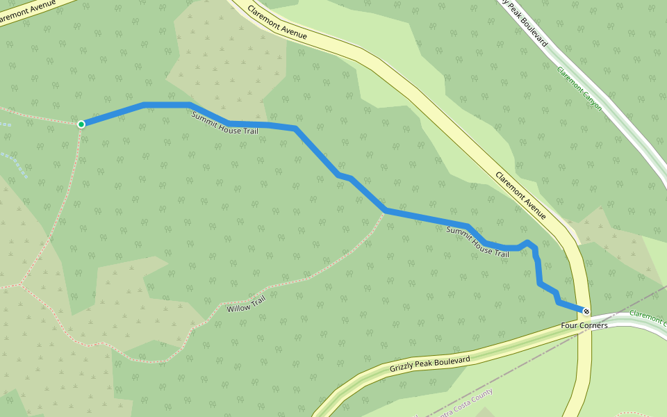
Summit House Trail Introduction
Summit House Trail is a 0.3 mile (500-step) route located near Berkeley, California. This route has an elevation gain of about 0 ft and is rated as easy. Find the best walking trails near you in Pacer App.
Open in App for Details
Map of Summit House Trail
© Mapbox © OpenStreetMap
View Full Map
View Full Map
Last updated: Mar 1, 2025
Route Details
Length
0.3 mi
Est. Steps
500
Recommended Routes Near Summit House Trail
Berkeley, California
Side Hill Trail
Length 0.3 mi
· Elev 49.2 ft
Berkeley, California
Sideo Dusty Extension
Length 0.2 mi
Berkeley, California
Gwin Caynon Trail
Length 0.8 mi
· Elev 196.8 ft
Berkeley, California
Gwin Canyon Trail
Length 0.2 mi
Orinda, California
Stables Trail
Length 0.3 mi
· Elev 42.6 ft
Berkeley, California
Sherwood Forest
Length 0.3 mi
Pacer Walking App
Pacer is the
best walking app
for walking challenges and finding
places to walk near me
.
Open in App for Details
Cancel
Yes
Pacer Walking App
The #1 Walking App
4.8
(1643K)
Open in App
Walking App
Near Me
Walking Clubs
Walking Challenges
Medals
For Workplaces