Pacer Walking App
The #1 Walking App
4.8
(1643K)
Open in App
Walking App
Near Me
Clubs
Challenges
Medals
For Workplaces
© Mapbox
© OpenStreetMap
Improve this map
© Mapbox
© OpenStreetMap
Improve this map
United States
Wisconsin
Custer
Old Highway 18 alignment
Custer, Wisconsin
United States
Wisconsin
Custer
Old Highway 18 alignment
1
reviews
Length
1.6 mi
Est. Steps
3500
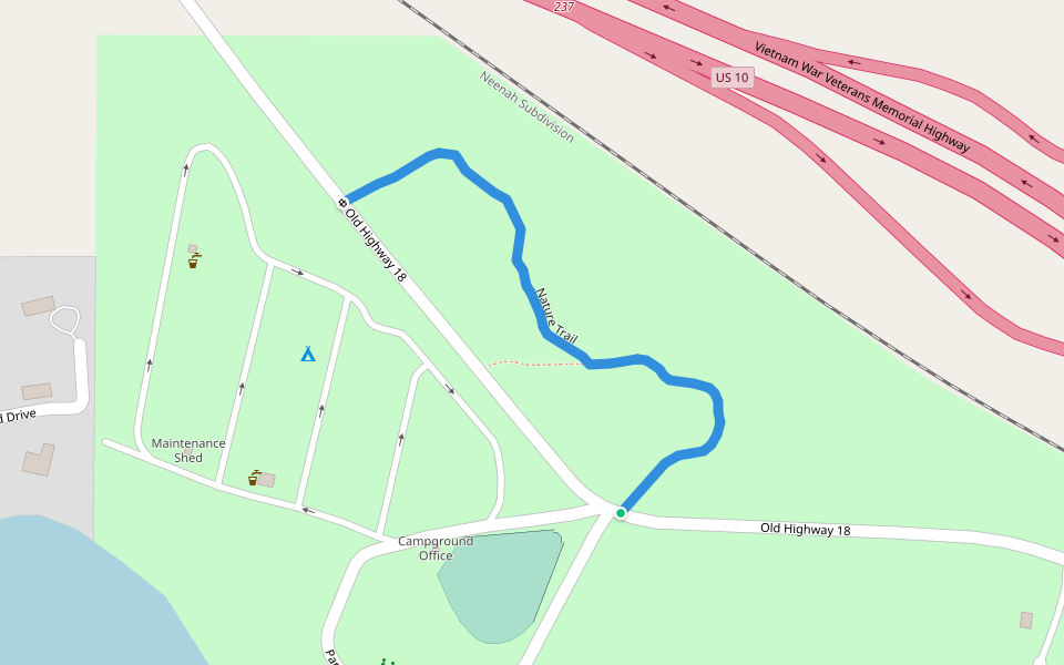
Old Highway 18 alignment Introduction
Old Highway 18 alignment is a 1.6 mile (3,500-step) route located near Custer, Wisconsin. This route has an elevation gain of about 0 ft and is rated as easy. Find the best walking trails near you in Pacer App.
Open in App for Details
Map of Old Highway 18 alignment
© Mapbox © OpenStreetMap
View Full Map
View Full Map
Last updated: Apr 1, 2025
Route Details
Length
1.6 mi
Est. Steps
3500
Recommended Routes Near Old Highway 18 alignment
Amherst Junction, Wisconsin
Nature Trail
Length 0.3 mi
Stevens Point, Wisconsin, USA
Standing Rocks Park
Length 0.8 mi
Stevens Point, Wisconsin
Lost Creek Wetland Hiking Trail
Length 1.3 mi
Scandinavia, Wisconsin
Tomorrow River State Trail
Length 7.6 mi
· Elev 3.3 ft
Amherst Junction, Wisconsin
Tomorrow River Trail
Length 1.5 mi
· Elev 13.1 ft
Plover, Wisconsin
Hoover Road Trail
Length 4.4 mi
· Elev 3.3 ft
Pacer Walking App
Pacer is the
best walking app
for walking challenges and finding
places to walk near me
.
Open in App for Details
Cancel
Yes
Pacer Walking App
The #1 Walking App
4.8
(1643K)
Open in App
Walking App
Near Me
Walking Clubs
Walking Challenges
Medals
For Workplaces