Pacer Walking App
The #1 Walking App
4.8
(1643K)
Open in App
Walking App
Near Me
Clubs
Challenges
Medals
For Workplaces
© Mapbox
© OpenStreetMap
Improve this map
© Mapbox
© OpenStreetMap
Improve this map
Canada
Ontario
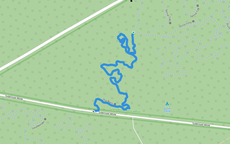
Turkey Point
The 226
Normandale, Ontario
Canada
Ontario
Turkey Point
The 226
1
reviews
Length
0.3 mi
Est. Steps
500
The 226 Introduction
The 226 is a 0.3 mile (500-step) route located near Normandale, Ontario. This route has an elevation gain of about 0 ft and is rated as easy. Find the best walking trails near you in Pacer App.
Open in App for Details
Map of The 226
© Mapbox © OpenStreetMap
View Full Map
View Full Map
Last updated: Mar 1, 2025
Route Details
Length
0.3 mi
Est. Steps
500
Recommended Routes Near The 226
Normandale, Ontario
Saudwinder
Length 0.9 mi
· Elev 9.8 ft
Vittoria, Ontario
Spinal Tap
Length 0.7 mi
Vittoria, Ontario
The Burn
Length 0.7 mi
Vittoria, Ontario
Earshot
Length 0.6 mi
Normandale, Ontario
Big Mike
Length 1.1 mi
· Elev 3.3 ft
Turkey Point, Ontario
Big Easy - Middle
Length 0.6 mi
Nearby Parks
Turkey Point Provincial Park
Pacer Walking App
Pacer is the
best walking app
for walking challenges and finding
places to walk near me
.
Open in App for Details
Cancel
Yes
Pacer Walking App
The #1 Walking App
4.8
(1643K)
Open in App
Walking App
Near Me
Walking Clubs
Walking Challenges
Medals
For Workplaces