Pacer Walking App
The #1 Walking App
4.8
(1643K)
Open in App
Walking App
Near Me
Clubs
Challenges
Medals
For Workplaces
© Mapbox
© OpenStreetMap
Improve this map
© Mapbox
© OpenStreetMap
Improve this map
France
Auvergne-Rhône-Alpes
Gex
Chemin du Coupe-Garrets
Gex, Auvergne-Rhône-Alpes
France
Auvergne-Rhône-Alpes
Gex
Chemin du Coupe-Garrets
1
reviews
Length
0.2 mi
Est. Steps
358
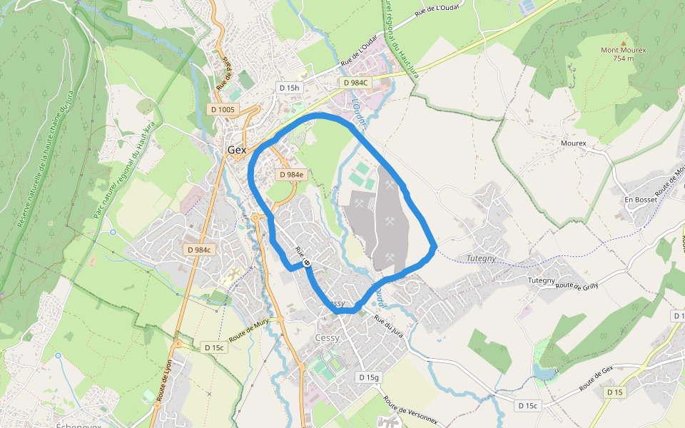
Chemin du Coupe-Garrets Introduction
Chemin du Coupe-Garrets is a 0.2 mile (358-step) route located near Gex, Auvergne-Rhône-Alpes. This route has an elevation gain of about 0 ft and is rated as easy. Find the best walking trails near you in Pacer App.
Open in App for Details
Map of Chemin du Coupe-Garrets
© Mapbox © OpenStreetMap
View Full Map
View Full Map
Last updated: Apr 1, 2025
Route Details
Length
0.2 mi
Est. Steps
358
Recommended Routes Near Chemin du Coupe-Garrets
Gex, Auvergne-Rhône-Alpes
Rue de Parozet
Length 0.2 mi
Gex, Auvergne-Rhône-Alpes
Path of Fire Life
Length 1 mi
· Elev 1253 ft
Gex, Auvergne-Rhône-Alpes
Journans promenade
Length 0.3 mi
Gex, Auvergne-Rhône-Alpes
Rue de Pré Bailly
Length 0.2 mi
Cessy, Auvergne-Rhône-Alpes
The Genets
Length 3.4 mi
Mijoux, Ain, France
Jura high chain nature reserve
Length 4.9 mi
· Elev 1722 ft
Pacer Walking App
Pacer is the
best walking app
for walking challenges and finding
places to walk near me
.
Open in App for Details
Cancel
Yes
Pacer Walking App
The #1 Walking App
4.8
(1643K)
Open in App
Walking App
Near Me
Walking Clubs
Walking Challenges
Medals
For Workplaces