Pacer Walking App
The #1 Walking App
4.8
(1643K)
Open in App
Walking App
Near Me
Clubs
Challenges
Medals
For Workplaces
© Mapbox
© OpenStreetMap
Improve this map
© Mapbox
© OpenStreetMap
Improve this map
Hong Kong
飛雲徑
Hong Kong, New Territories
Hong Kong
飛雲徑
1
reviews
Length
0.4 mi
Est. Steps
1000
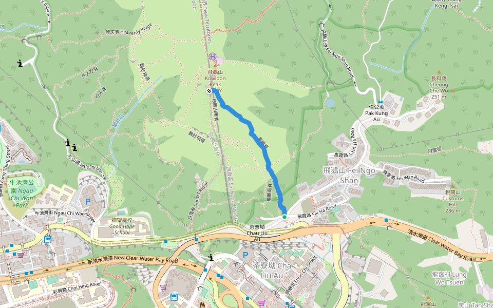
飛雲徑 Introduction
飛雲徑 is a 0.4 mile (1,000-step) route located near Hong Kong, New Territories. This route has an elevation gain of about 0 ft and is rated as easy. Find the best walking trails near you in Pacer App.
Open in App for Details
Map of 飛雲徑
© Mapbox © OpenStreetMap
View Full Map
View Full Map
Reviews
4
(1)
hui
2023/10/28
Last updated: Apr 1, 2025
Route Details
Length
0.4 mi
Est. Steps
1000
Recommended Routes Near 飛雲徑
Sai Kung District, Hong Kong
Hawaii Trail
Length 1.9 mi
· Elev 62.3 ft
Sai Kung District, Hong Kong
Ma On Shan Country Park-Kowloon Peak Viewing Point
Length 6.9 mi
· Elev 1489.1 ft
Hong Kong, New Territories
恩緣脊
Length 0.4 mi
· Elev 1049.6 ft
Hong Kong, New Territories
飛鵝南脊
Length 0.2 mi
Hong Kong, New Territories
崎嶇
Length 0.2 mi
Hong Kong, New Territories
高危
Length 0.2 mi
· Elev 209.9 ft
Pacer Walking App
Pacer is the
best walking app
for walking challenges and finding
places to walk near me
.
Open in App for Details
Cancel
Yes
Pacer Walking App
The #1 Walking App
4.8
(1643K)
Open in App
Walking App
Near Me
Walking Clubs
Walking Challenges
Medals
For Workplaces