Pacer Walking App
The #1 Walking App
4.8
(1643K)
Open in App
Walking App
Near Me
Clubs
Challenges
Medals
For Workplaces
© Mapbox
© OpenStreetMap
Improve this map
© Mapbox
© OpenStreetMap
Improve this map
Canada
British Columbia
Mount Currie
Valentine Lake Trail
Creekside, British Columbia
Canada
British Columbia
Mount Currie
Valentine Lake Trail
1
reviews
Length
4.1 mi
Elev. Gain
2227.1 ft
Est. Steps
9500
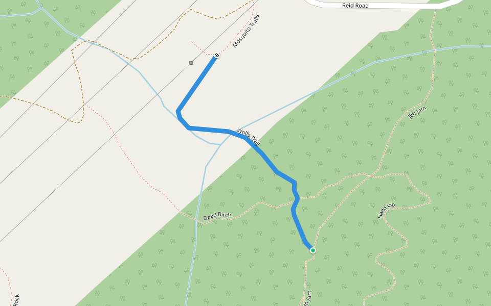
Valentine Lake Trail Introduction
Valentine Lake Trail is a 4.1 mile (9,500-step) route located near Creekside, British Columbia. This route has an elevation gain of about 2227.1 ft and is rated as hard. Find the best walking trails near you in Pacer App.
Open in App for Details
Map of Valentine Lake Trail
© Mapbox © OpenStreetMap
View Full Map
View Full Map
Last updated: Mar 1, 2025
Route Details
Length
4.1 mi
Elev. Gain
2227.1 ft
Est. Steps
9500
Recommended Routes Near Valentine Lake Trail
Owl Creek, British Columbia
Ressurectum
Length 1.5 mi
· Elev 16.4 ft
Owl Creek, British Columbia
Dead Birch
Length 0.3 mi
Owl Creek, British Columbia
Hand Job
Length 0.4 mi
· Elev 127.9 ft
Owl Creek, British Columbia
Wolf's Trail
Length 0.3 mi
Owl Creek, British Columbia
JK Traverse
Length 0.3 mi
Squamish-Lillooet Regional District, British Columbia, Canada
Mosquito Lake Road
Length 3.9 mi
· Elev 1200.5 ft
Pacer Walking App
Pacer is the
best walking app
for walking challenges and finding
places to walk near me
.
Open in App for Details
Cancel
Yes
Pacer Walking App
The #1 Walking App
4.8
(1643K)
Open in App
Walking App
Near Me
Walking Clubs
Walking Challenges
Medals
For Workplaces