Pacer Walking App
The #1 Walking App
4.8
(1643K)
Open in App
Walking App
Near Me
Clubs
Challenges
Medals
For Workplaces
© Mapbox
© OpenStreetMap
Improve this map
© Mapbox
© OpenStreetMap
Improve this map
Austria
Zirl
Steig Kaiser-Max-Grotte
Zirl, Tirol
Austria
Zirl
Steig Kaiser-Max-Grotte
1
reviews
Length
0.5 mi
Elev. Gain
200.1 ft
Est. Steps
1000
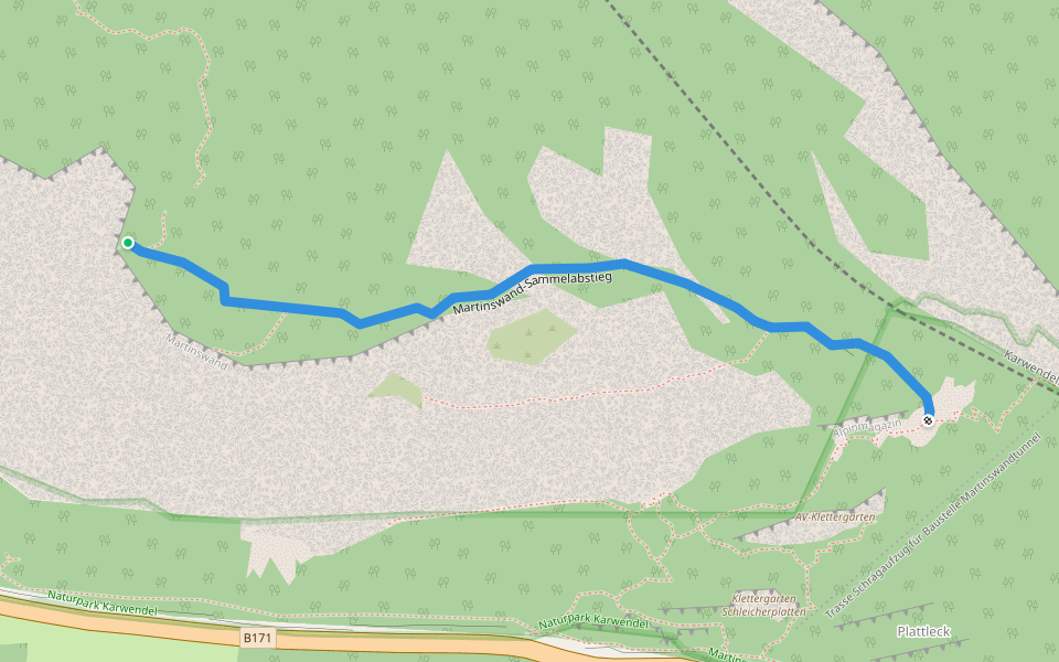
Steig Kaiser-Max-Grotte Introduction
Steig Kaiser-Max-Grotte is a 0.5 mile (1,000-step) route located near Zirl, Tirol. This route has an elevation gain of about 200.1 ft and is rated as hard. Find the best walking trails near you in Pacer App.
Open in App for Details
Map of Steig Kaiser-Max-Grotte
© Mapbox © OpenStreetMap
View Full Map
View Full Map
Last updated: Apr 1, 2025
Route Details
Length
0.5 mi
Elev. Gain
200.1 ft
Est. Steps
1000
Recommended Routes Near Steig Kaiser-Max-Grotte
Zirl, Tyrol, Austria
Brunntal way
Length 2.4 mi
· Elev 843 ft
Zirl, Tirol
Martinswand collective descent
Length 0.4 mi
Zirl, Tirol
Ehnbach Klamm path
Length 0.5 mi
· Elev 551 ft
Zirl, Tirol
3 Ehnbachklamm - Zirl
Length 0.9 mi
Zirl, Tirol
Vogellehrweg
Length 0.7 mi
· Elev 544.5 ft
Zirl, Tirol
Adlerweg Stage 14
Length 4.2 mi
· Elev 2584.6 ft
Pacer Walking App
Pacer is the
best walking app
for walking challenges and finding
places to walk near me
.
Open in App for Details
Cancel
Yes
Pacer Walking App
The #1 Walking App
4.8
(1643K)
Open in App
Walking App
Near Me
Walking Clubs
Walking Challenges
Medals
For Workplaces