Pacer Walking App
The #1 Walking App
4.8
(1643K)
Open in App
Walking App
Near Me
Clubs
Challenges
Medals
For Workplaces
© Mapbox
© OpenStreetMap
Improve this map
© Mapbox
© OpenStreetMap
Improve this map
Routes
Toscana
Gallicano
Tigliora path
Gallicano, Toscana
Gallicano, Toscana
Tigliora path
1
reviews
Length
1.8 mi
Est. Steps
4500
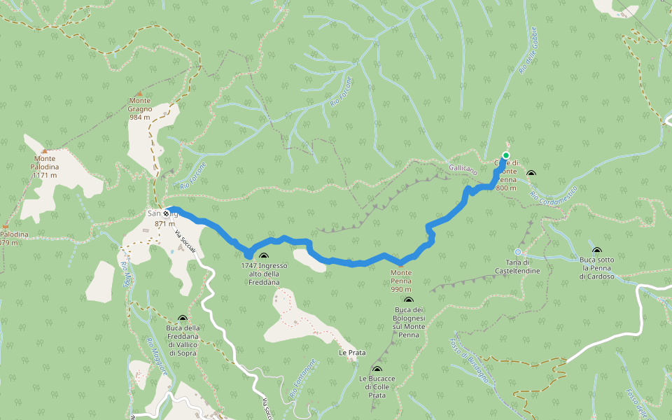
Tigliora path Introduction
Tigliora path is a 1.9 mile (4,500-step) route located near Gallicano, Toscana. This route has an elevation gain of about 0 ft and is rated as easy. Find the best walking trails near you in Pacer App.
Open in App for Details
Map of Tigliora path
© Mapbox © OpenStreetMap
View Full Map
View Full Map
Last updated: Apr 1, 2025
Route Details
Length
1.8 mi
Est. Steps
4500
Recommended Routes Near Tigliora path
Gallicano, Toscana
Variant of the Tigliora path
Length 0.1 mi
Gallicano, Province of Lucca, Italy
The Molino di Verni
Length 2.8 mi
· Elev 364.1 ft
Vallico di Sopra, Toscana
The Cross – Monte Penna – S. Luigi
Length 1.4 mi
· Elev 639.6 ft
Trassilico, Toscana
Via Leonardo Nobli
Length 0.2 mi
· Elev 39.4 ft
Fabbriche di Vergemoli, Toscana
La Piazzola (path 136) - Tana di Casteltendine - La Scaletta - Vallico di Sopra - San Luigi (crossing path 136) - Monte Palodina - Foce Palodina (path 136)
Length 3.6 mi
· Elev 2043.4 ft
Trassilico, Toscana
Via Antonio Vallisneri
Length 0.2 mi
· Elev 39.4 ft
Pacer Walking App
Pacer is the
best walking app
for walking challenges and finding
places to walk near me
.
Open in App for Details
Cancel
Yes
Pacer Walking App
The #1 Walking App
4.8
(1643K)
Open in App
Walking App
Near Me
Walking Clubs
Walking Challenges
Medals
For Workplaces