Pacer Walking App
The #1 Walking App
4.8
(1643K)
Open in App
Walking App
Near Me
Clubs
Challenges
Medals
For Workplaces
© Mapbox
© OpenStreetMap
Improve this map
© Mapbox
© OpenStreetMap
Improve this map
France
Hauts-de-France
Ault
Fern Trail
Ault, Hauts-de-France
France
Hauts-de-France
Ault
Fern Trail
1
reviews
Length
0.1 mi
Est. Steps
342
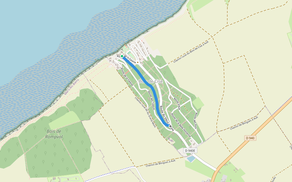
Fern Trail Introduction
Fern Trail is a 0.1 mile (342-step) route located near Ault, Hauts-de-France. This route has an elevation gain of about 0 ft and is rated as easy. Find the best walking trails near you in Pacer App.
Open in App for Details
Map of Fern Trail
© Mapbox © OpenStreetMap
View Full Map
View Full Map
Last updated: Mar 1, 2025
Route Details
Length
0.1 mi
Est. Steps
342
Recommended Routes Near Fern Trail
Ault, Hauts-de-France
Hazelnut Alley
Length 0.1 mi
Ault, Hauts-de-France
Allée Germaine
Length 0.3 mi
Ault, Hauts-de-France
Allée Marie
Length 0.6 mi
· Elev 55.8 ft
Saint-Quentin-la-Motte-Croix-au-Bailly, Hauts-de-France
Ruelle du Bisgaret
Length 0.2 mi
Saint-Quentin-la-Motte-Croix-au-Bailly, Hauts-de-France
Castle Alley
Length 0.3 mi
Saint-Quentin-la-Motte-Croix-au-Bailly, Hauts-de-France
Allée Abbé Max Bougon
Length 0.2 mi
Pacer Walking App
Pacer is the
best walking app
for walking challenges and finding
places to walk near me
.
Open in App for Details
Cancel
Yes
Pacer Walking App
The #1 Walking App
4.8
(1643K)
Open in App
Walking App
Near Me
Walking Clubs
Walking Challenges
Medals
For Workplaces