Pacer Walking App
The #1 Walking App
4.8
(1643K)
Open in App
Walking App
Near Me
Clubs
Challenges
Medals
For Workplaces
© Mapbox
© OpenStreetMap
Improve this map
© Mapbox
© OpenStreetMap
Improve this map
Spain
Ucero
Gullurías Path
Ucero, Castilla y León
Spain
Ucero
Gullurías Path
1
reviews
Length
2.5 mi
Elev. Gain
528.1 ft
Est. Steps
5500
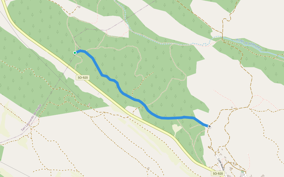
Gullurías Path Introduction
Gullurías Path is a 2.5 mile (5,500-step) route located near Ucero, Castilla y León. This route has an elevation gain of about 528.1 ft and is rated as medium. Find the best walking trails near you in Pacer App.
Open in App for Details
Map of Gullurías Path
© Mapbox © OpenStreetMap
View Full Map
View Full Map
Last updated: Mar 1, 2025
Route Details
Length
2.5 mi
Elev. Gain
528.1 ft
Est. Steps
5500
Recommended Routes Near Gullurías Path
Santa María de las Hoyas, Castilla y León
PR-SO-BU-65 River Path
Length 14.5 mi
· Elev 521.5 ft
Ucero, Castilla y León
Path of the Gullurías
Length 2.5 mi
· Elev 426.4 ft
Nafría de Ucero, Castilla y León
Billido Castle Trail
Length 0.4 mi
Santa María de las Hoyas, Castilla y León
Chorrón Trail
Length 1.1 mi
· Elev 45.9 ft
Casarejos, Castilla y León
Saint Leonard's Path
Length 1.2 mi
· Elev 59 ft
Valdegrulla, Castilla y León
Fountain Street
Length 0.1 mi
Pacer Walking App
Pacer is the
best walking app
for walking challenges and finding
places to walk near me
.
Open in App for Details
Cancel
Yes
Pacer Walking App
The #1 Walking App
4.8
(1643K)
Open in App
Walking App
Near Me
Walking Clubs
Walking Challenges
Medals
For Workplaces