Pacer Walking App
The #1 Walking App
4.8
(1643K)
Open in App
Walking App
Near Me
Clubs
Challenges
Medals
For Workplaces
© Mapbox
© OpenStreetMap
Improve this map
© Mapbox
© OpenStreetMap
Improve this map
United States
California
South Lake Tahoe
Ridge Path
Nebelhorn, California
United States
California
South Lake Tahoe
Ridge Path
1
reviews
Length
0.6 mi
Est. Steps
1500
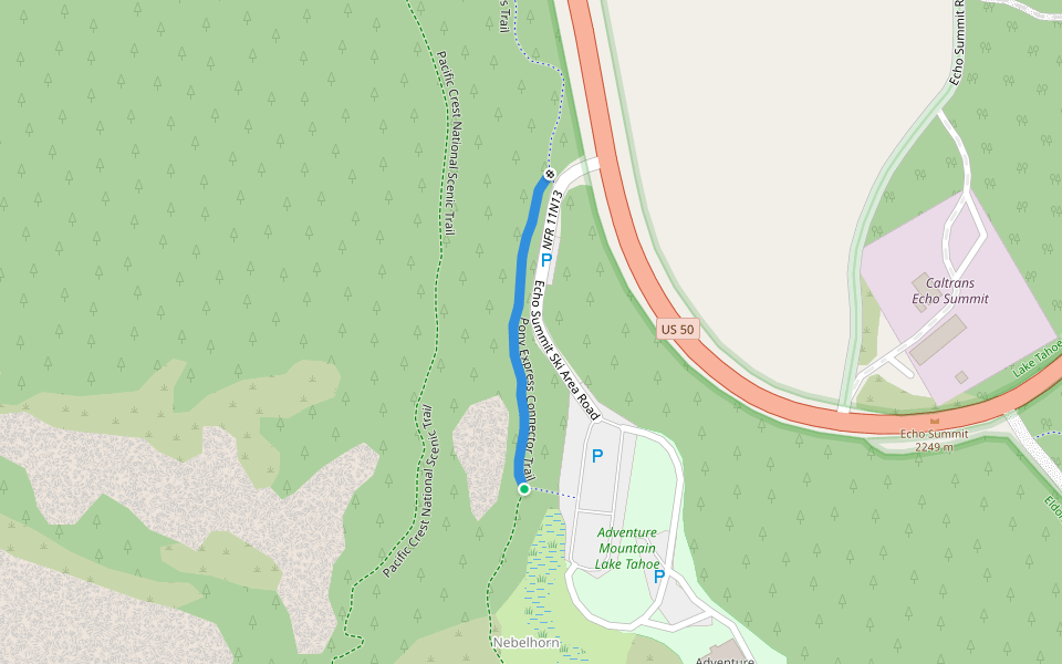
Ridge Path Introduction
Ridge Path is a 0.6 mile (1,500-step) route located near Nebelhorn, California. This route has an elevation gain of about 0 ft and is rated as easy. Find the best walking trails near you in Pacer App.
Open in App for Details
Map of Ridge Path
© Mapbox © OpenStreetMap
View Full Map
View Full Map
Last updated: Apr 1, 2025
Route Details
Length
0.6 mi
Est. Steps
1500
Recommended Routes Near Ridge Path
South Lake Tahoe, California
Hawley Grade National Recreation Trail
Length 1.8 mi
· Elev 19.7 ft
South Lake Tahoe, California
Pony Express Connector Trail
Length 0.2 mi
South Lake Tahoe, California
Echo Summit Trailhead Access Spur
Length 0.4 mi
South Lake Tahoe, California
Old Meyers Grade
Length 1.4 mi
South Lake Tahoe, California
Benwood Residential Spur
Length 0.6 mi
· Elev 26.2 ft
South Lake Tahoe, California
Saxon Connector
Length 1.4 mi
· Elev 131.2 ft
Pacer Walking App
Pacer is the
best walking app
for walking challenges and finding
places to walk near me
.
Open in App for Details
Cancel
Yes
Pacer Walking App
The #1 Walking App
4.8
(1643K)
Open in App
Walking App
Near Me
Walking Clubs
Walking Challenges
Medals
For Workplaces