Pacer Walking App
The #1 Walking App
4.8
(1643K)
Open in App
Walking App
Near Me
Clubs
Challenges
Medals
For Workplaces
© Mapbox
© OpenStreetMap
Improve this map
© Mapbox
© OpenStreetMap
Improve this map
France
Centre-Val de Loire
Lerné
Operating Path
Seuilly, Centre-Val de Loire
France
Centre-Val de Loire
Lerné
Operating Path
1
reviews
Length
1.4 mi
Elev. Gain
16.4 ft
Est. Steps
3000
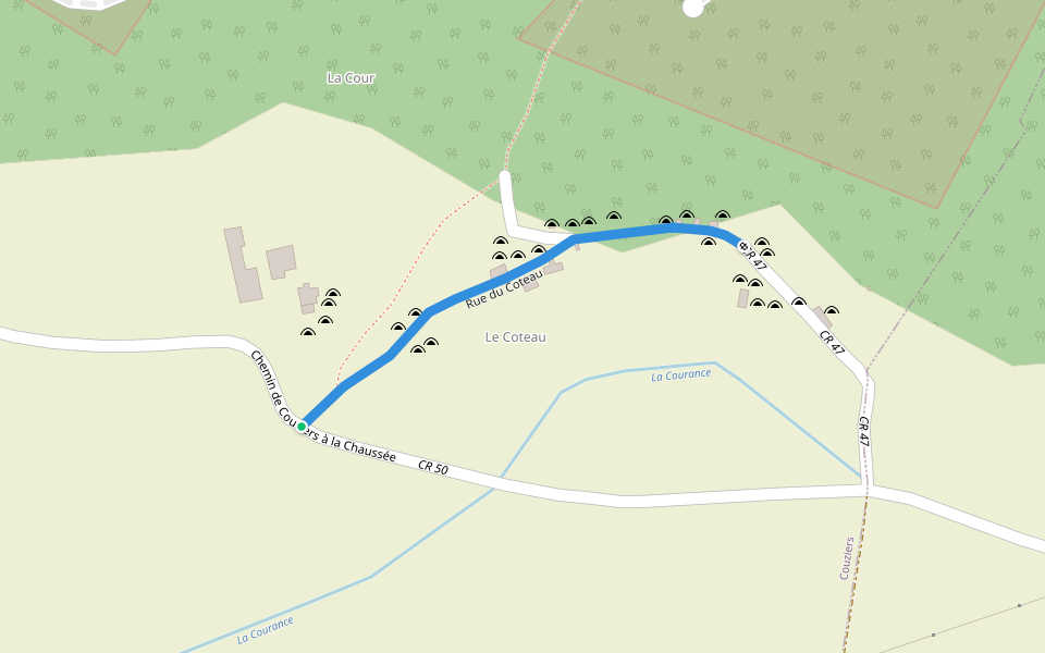
Operating Path Introduction
Operating Path is a 1.4 mile (3,000-step) route located near Seuilly, Centre-Val de Loire. This route has an elevation gain of about 16.4 ft and is rated as easy. Find the best walking trails near you in Pacer App.
Open in App for Details
Map of Operating Path
© Mapbox © OpenStreetMap
View Full Map
View Full Map
Last updated: Mar 1, 2025
Route Details
Length
1.4 mi
Elev. Gain
16.4 ft
Est. Steps
3000
Recommended Routes Near Operating Path
Seuilly, Centre-Val de Loire
Rabelais Trail
Length 0.5 mi
· Elev 19.7 ft
Seuilly, Centre-Val de Loire
Path from Moulin de Vrilly to Moulin du Pont
Length 0.4 mi
Couziers, Centre-Val de Loire
Rue du Coteau
Length 0.2 mi
Saint-Germain-sur-Vienne, Centre-Val de Loire
Chemin du Carroi du Bois de la Taille Ally at the Chaussée
Length 0.7 mi
Couziers, Centre-Val de Loire
Chemin de la Petite Courance
Length 0.2 mi
Couziers, Centre-Val de Loire
Path from Candes-Saint-Martin to Couziers
Length 0.6 mi
Pacer Walking App
Pacer is the
best walking app
for walking challenges and finding
places to walk near me
.
Open in App for Details
Cancel
Yes
Pacer Walking App
The #1 Walking App
4.8
(1643K)
Open in App
Walking App
Near Me
Walking Clubs
Walking Challenges
Medals
For Workplaces