Pacer Walking App
The #1 Walking App
4.8
(1643K)
Open in App
Walking App
Near Me
Clubs
Challenges
Medals
For Workplaces
© Mapbox
© OpenStreetMap
Improve this map
© Mapbox
© OpenStreetMap
Improve this map
France
Auvergne-Rhône-Alpes
Nantua
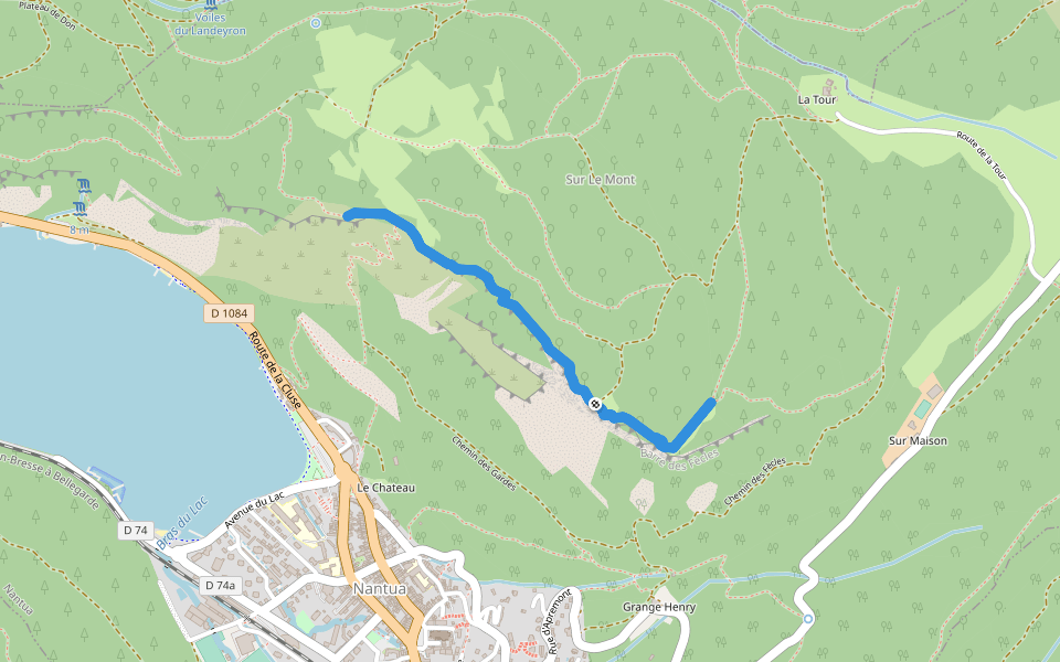
Path of the Guards
Nantua, Auvergne-Rhône-Alpes
France
Auvergne-Rhône-Alpes
Nantua
Path of the Guards
1
reviews
Length
0.4 mi
Est. Steps
1000
Path of the Guards Introduction
Path of the Guards is a 0.4 mile (1,000-step) route located near Nantua, Auvergne-Rhône-Alpes. This route has an elevation gain of about 0 ft and is rated as easy. Find the best walking trails near you in Pacer App.
Open in App for Details
Map of Path of the Guards
© Mapbox © OpenStreetMap
View Full Map
View Full Map
Last updated: Apr 1, 2025
Route Details
Length
0.4 mi
Est. Steps
1000
Recommended Routes Near Path of the Guards
Nantua, Auvergne-Rhône-Alpes
The Column
Length 1.9 mi
· Elev 708.5 ft
Nantua, Ain, France
Lake Nantua
Length 4.1 mi
Nantua, Auvergne-Rhône-Alpes
The Wonderful Rock
Length 0.9 mi
· Elev 495.3 ft
Nantua, Auvergne-Rhône-Alpes
Chemin des Fècles
Length 3.1 mi
· Elev 1325.1 ft
Port, Auvergne-Rhône-Alpes
Village Road in Chamoise
Length 0.8 mi
· Elev 544.5 ft
Saint-Martin-du-Frêne, Ain, France
Oignin
Length 3.2 mi
Pacer Walking App
Pacer is the
best walking app
for walking challenges and finding
places to walk near me
.
Open in App for Details
Cancel
Yes
Pacer Walking App
The #1 Walking App
4.8
(1643K)
Open in App
Walking App
Near Me
Walking Clubs
Walking Challenges
Medals
For Workplaces