Pacer Walking App
The #1 Walking App
4.8
(1643K)
Open in App
Walking App
Near Me
Clubs
Challenges
Medals
For Workplaces
© Mapbox
© OpenStreetMap
Improve this map
© Mapbox
© OpenStreetMap
Improve this map
France
Île-de-France
Saint-Léger-en-Yvelines
Bird Path
Saint-Léger-en-Yvelines, Île-de-France
France
Île-de-France
Saint-Léger-en-Yvelines
Bird Path
1
reviews
Length
0.4 mi
Est. Steps
1000
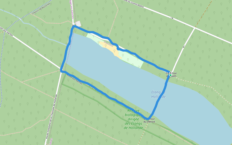
Bird Path Introduction
Bird Path is a 0.4 mile (1,000-step) route located near Saint-Léger-en-Yvelines, Île-de-France. This route has an elevation gain of about 0 ft and is rated as easy. Find the best walking trails near you in Pacer App.
Open in App for Details
Map of Bird Path
© Mapbox © OpenStreetMap
View Full Map
View Full Map
Reviews
4.5
(1)
Marie-elisabeth
2024/04/28
Last updated: Apr 1, 2025
Route Details
Length
0.4 mi
Est. Steps
1000
Recommended Routes Near Bird Path
Les Bréviaires, Île-de-France
Route des Bergeries
Length 1.1 mi
Saint-Léger-en-Yvelines, Île-de-France
Beech Chimney Sweep Route
Length 0.3 mi
Saint-Léger-en-Yvelines, Île-de-France
Elm Road
Length 1.2 mi
Saint-Léger-en-Yvelines, Île-de-France
Route of the Grand Master
Length 0.4 mi
Saint-Léger-en-Yvelines, Île-de-France
Chevalier Park Road
Length 1.8 mi
Les Bréviaires, Yvelines, France
Pond of holland
Length 1.3 mi
Pacer Walking App
Pacer is the
best walking app
for walking challenges and finding
places to walk near me
.
Open in App for Details
Cancel
Yes
Pacer Walking App
The #1 Walking App
4.8
(1643K)
Open in App
Walking App
Near Me
Walking Clubs
Walking Challenges
Medals
For Workplaces