Pacer Walking App
The #1 Walking App
4.8
(1643K)
Open in App
Walking App
Near Me
Clubs
Challenges
Medals
For Workplaces
© Mapbox
© OpenStreetMap
Improve this map
© Mapbox
© OpenStreetMap
Improve this map
United States
Washington
Ashford
Boundary trail
Ashford, Washington
United States
Washington
Ashford
Boundary trail
1
reviews
Length
3.4 mi
Elev. Gain
3512.9 ft
Est. Steps
8000
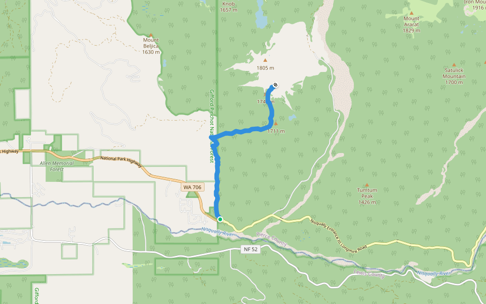
Boundary trail Introduction
Boundary trail is a 3.4 mile (8,000-step) route located near Ashford, Washington. This route has an elevation gain of about 3512.9 ft and is rated as hard. Find the best walking trails near you in Pacer App.
Open in App for Details
Map of Boundary trail
© Mapbox © OpenStreetMap
View Full Map
View Full Map
Last updated: Mar 1, 2025
Route Details
Length
3.4 mi
Elev. Gain
3512.9 ft
Est. Steps
8000
Recommended Routes Near Boundary trail
Ashford, Washington
Mount Wow
Length 3.4 mi
· Elev 3512.9 ft
Eatonville, Washington
Lake Christine Trail #249
Length 1.7 mi
· Elev 662.6 ft
Eatonville, Washington
Lake Christine Trail #249
Length 1.7 mi
· Elev 662.6 ft
Ashford, Washington
Teeley Creek Trail #251
Length 4 mi
· Elev 1121.8 ft
Ashford, Washington
Osborne Mountain Trail #250
Length 4.9 mi
· Elev 741.3 ft
Ashford, Washington
Kautz Creek Trail
Length 5.2 mi
· Elev 3139 ft
Nearby Parks
Mount Rainier National Park
Pacer Walking App
Pacer is the
best walking app
for walking challenges and finding
places to walk near me
.
Open in App for Details
Cancel
Yes
Pacer Walking App
The #1 Walking App
4.8
(1643K)
Open in App
Walking App
Near Me
Walking Clubs
Walking Challenges
Medals
For Workplaces