Pacer Walking App
The #1 Walking App
4.8
(1643K)
Open in App
Walking App
Near Me
Clubs
Challenges
Medals
For Workplaces
© Mapbox
© OpenStreetMap
Improve this map
© Mapbox
© OpenStreetMap
Improve this map
Denmark
North Denmark Region
Thisted
Rindbæk Route
Thisted
Denmark
North Denmark Region
Thisted
Rindbæk Route
1
reviews
Length
1.2 mi
Est. Steps
3000
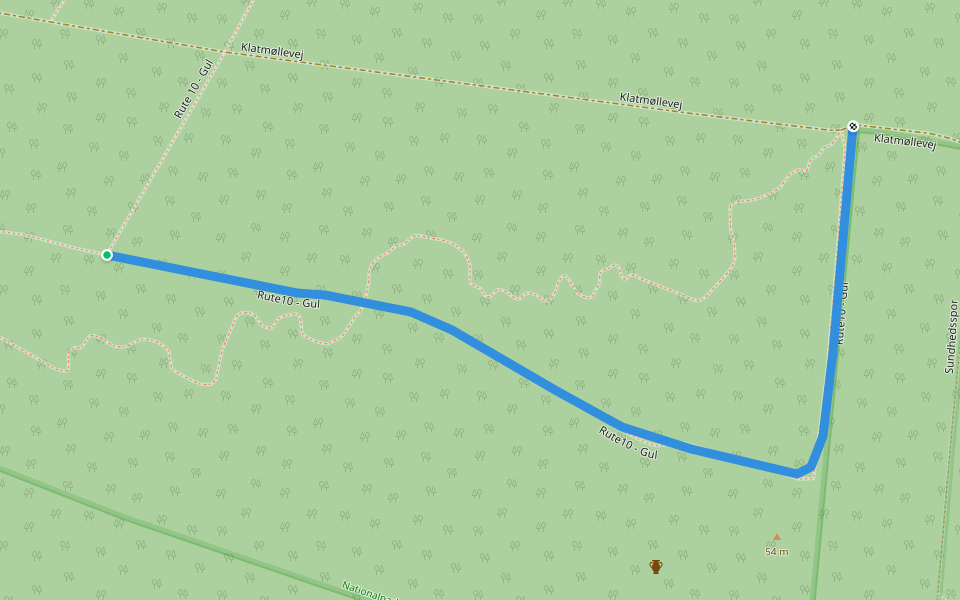
Rindbæk Route Introduction
Rindbæk Route is a 1.2 mile (3,000-step) route located near Thisted. This route has an elevation gain of about 0 ft and is rated as easy. Find the best walking trails near you in Pacer App.
Open in App for Details
Map of Rindbæk Route
© Mapbox © OpenStreetMap
View Full Map
View Full Map
Last updated: Apr 1, 2025
Route Details
Length
1.2 mi
Est. Steps
3000
Recommended Routes Near Rindbæk Route
Thisted
Nystrup Plantage Blue heart trail
Length 3.1 mi
· Elev 42.6 ft
Thisted
The Nystrup route
Length 2.7 mi
· Elev 124.6 ft
Thisted, North Denmark Region
Rute10 - Gul
Length 0.4 mi
Thisted
The water pipe
Length 4.5 mi
· Elev 78.7 ft
Thisted, North Denmark Region
Sundhedsspor
Length 1.4 mi
· Elev 6.6 ft
Thisted
Hoverimruten
Length 2.6 mi
· Elev 13.1 ft
Pacer Walking App
Pacer is the
best walking app
for walking challenges and finding
places to walk near me
.
Open in App for Details
Cancel
Yes
Pacer Walking App
The #1 Walking App
4.8
(1643K)
Open in App
Walking App
Near Me
Walking Clubs
Walking Challenges
Medals
For Workplaces