Pacer Walking App
The #1 Walking App
4.8
(1643K)
Open in App
Walking App
Near Me
Clubs
Challenges
Medals
For Workplaces
© Mapbox
© OpenStreetMap
Improve this map
© Mapbox
© OpenStreetMap
Improve this map
France
Auvergne-Rhône-Alpes
Dore-l'Église
The panoramas of Dore l'Eglise
Dore-l'Église, Auvergne-Rhône-Alpes
France
Auvergne-Rhône-Alpes
Dore-l'Église
The panoramas of Dore l'Eglise
1
reviews
Length
10.7 mi
Elev. Gain
1387.4 ft
Est. Steps
25000
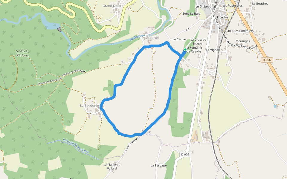
The panoramas of Dore l'Eglise Introduction
The panoramas of Dore l'Eglise is a 10.7 mile (25,000-step) route located near Dore-l'Église, Auvergne-Rhône-Alpes. This route has an elevation gain of about 1387.4 ft and is rated as hard. Find the best walking trails near you in Pacer App.
Open in App for Details
Map of The panoramas of Dore l'Eglise
© Mapbox © OpenStreetMap
View Full Map
View Full Map
Last updated: Mar 1, 2025
Route Details
Length
10.7 mi
Elev. Gain
1387.4 ft
Est. Steps
25000
Recommended Routes Near The panoramas of Dore l'Eglise
Medeyrolles, Auvergne-Rhône-Alpes
The Upper Arzon Valley
Length 5.5 mi
· Elev 269 ft
Beurières, Auvergne-Rhône-Alpes
Montravel
Length 6.9 mi
· Elev 1134.9 ft
Dore-l'Église, Auvergne-Rhône-Alpes
Rural Road from Verdelet to Maples
Length 0.5 mi
· Elev 82 ft
Arlanc, Puy-de-Dôme, France
Way of Saint-Alyre
Length 2 mi
· Elev 282.1 ft
Arlanc, Auvergne-Rhône-Alpes
The Chalas dam
Length 3.8 mi
· Elev 314.9 ft
Sauvessanges, Auvergne-Rhône-Alpes
Sauvessannelles
Length 5.6 mi
· Elev 656 ft
Pacer Walking App
Pacer is the
best walking app
for walking challenges and finding
places to walk near me
.
Open in App for Details
Cancel
Yes
Pacer Walking App
The #1 Walking App
4.8
(1643K)
Open in App
Walking App
Near Me
Walking Clubs
Walking Challenges
Medals
For Workplaces