Pacer Walking App
The #1 Walking App
4.8
(1643K)
Open in App
Walking App
Near Me
Clubs
Challenges
Medals
For Workplaces
© Mapbox
© OpenStreetMap
Improve this map
© Mapbox
© OpenStreetMap
Improve this map
Italy
Umbria
Vernazzano Basso
Frassati Path
Passignano sul Trasimeno, Umbria
Italy
Umbria
Vernazzano Basso
Frassati Path
1
reviews
Length
6.3 mi
Elev. Gain
1131.6 ft
Est. Steps
14000
Frassati Path Introduction
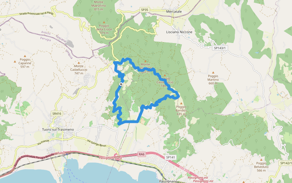
Frassati Path is a 6.3 mile (14,000-step) route located near Passignano sul Trasimeno, Umbria. This route has an elevation gain of about 1131.6 ft and is rated as hard. Find the best walking trails near you in Pacer App.
Open in App for Details
Map of Frassati Path
© Mapbox © OpenStreetMap
View Full Map
View Full Map
Last updated: Mar 1, 2025
Route Details
Length
6.3 mi
Elev. Gain
1131.6 ft
Est. Steps
14000
Recommended Routes Near Frassati Path
Umbria
Borgo Torale-Vernazzano-Cima Tuoro-Pischiello
Length 8.1 mi
· Elev 1269.4 ft
Umbria
Town Hall Square
Length 3.6 mi
Umbria
The Via del Trasimeno Stage 7
Length 15.9 mi
· Elev 2027 ft
Passignano sul Trasimeno, Umbria
The Martinella
Length 6.6 mi
· Elev 905.3 ft
Umbria
Passignano - Poggio Belveduto
Length 8.9 mi
· Elev 990.6 ft
Passignano sul Trasimeno, Perugia, Italy
La Martinella
Length 1.8 mi
· Elev 423.1 ft
Pacer Walking App
Pacer is the
best walking app
for walking challenges and finding
places to walk near me
.
Open in App for Details
Cancel
Yes
Pacer Walking App
The #1 Walking App
4.8
(1643K)
Open in App
Walking App
Near Me
Walking Clubs
Walking Challenges
Medals
For Workplaces