Pacer Walking App
The #1 Walking App
4.8
(1643K)
Open in App
Walking App
Near Me
Clubs
Challenges
Medals
For Workplaces
© Mapbox
© OpenStreetMap
Improve this map
© Mapbox
© OpenStreetMap
Improve this map
United States
Washington
Winthrop
Cady Pass Trail
Winthrop, Washington
United States
Washington
Winthrop
Cady Pass Trail
1
reviews
Length
8.6 mi
Elev. Gain
1607.2 ft
Est. Steps
20000
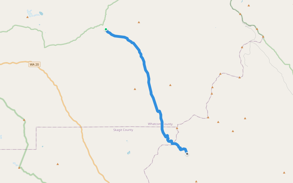
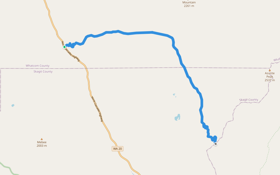
Cady Pass Trail Introduction
Cady Pass Trail is a 8.6 mile (20,000-step) route located near Winthrop, Washington. This route has an elevation gain of about 1607.2 ft and is rated as hard. Find the best walking trails near you in Pacer App.
Open in App for Details
Map of Cady Pass Trail
© Mapbox © OpenStreetMap
View Full Map
View Full Map
Last updated: Apr 1, 2025
Route Details
Length
8.6 mi
Elev. Gain
1607.2 ft
Est. Steps
20000
Recommended Routes Near Cady Pass Trail
Winthrop, Washington
Cady Pass Trail
Length 8.6 mi
· Elev 1607.2 ft
Winthrop, Washington
Mill Creek Trail (abandoned)
Length 8.9 mi
· Elev 3467 ft
Cedar Crossing, Washington
East Creek Trail
Length 9.3 mi
· Elev 3378.4 ft
Winthrop, Washington
East Creek Trail
Length 7 mi
· Elev 3070.1 ft
Winthrop, Washington
Pacific Crest National Scenic Trail #2000
Length 25.5 mi
· Elev 3991.8 ft
Winthrop, Washington
Methow River Trail 480
Length 5.2 mi
· Elev 23 ft
Pacer Walking App
Pacer is the
best walking app
for walking challenges and finding
places to walk near me
.
Open in App for Details
Cancel
Yes
Pacer Walking App
The #1 Walking App
4.8
(1643K)
Open in App
Walking App
Near Me
Walking Clubs
Walking Challenges
Medals
For Workplaces