Open in App
pacer logo
F - Winter hike to Freibergsee walking route map in Oberstdorf, Bayern
GermanyBreadcrumb separatorOberstdorfBreadcrumb separator
F - Winter hike to Freibergsee
Oberstdorf, Bayern

F - Winter hike to Freibergsee

Rating StarRating StarRating StarRating StarRating Star
1
 reviews
Length4.9 mi
Elev. Gain793.8 ft
Est. Steps11000

F - Winter hike to Freibergsee Introduction

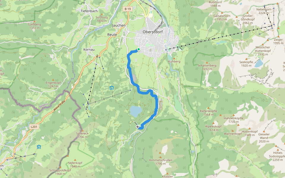
F - Winter hike to Freibergsee is a 4.9 mile (11,000-step) route located near Oberstdorf, Bayern. This route has an elevation gain of about 793.8 ft and is rated as medium. Find the best walking trails near you in Pacer App.
Winterwanderweg : Weststraße – Schlechtenbrücke - Waldesruhe – Bergkristallweg – Edmund-Probst-Weg – Freibergsee – unterer Renksteg – Südebene – Gertrud von le Fort Weg
Last updated: Mar 1, 2025

Route Details

Detail Icon

Length

4.9 mi
Detail Icon

Elev. Gain

793.8 ft
Detail Icon

Est. Steps

11000
pacer

Pacer Walking App

Pacer is the best walking app for walking challenges and finding places to walk near me.