Pacer Walking App
The #1 Walking App
4.8
(1643K)
Open in App
Walking App
Near Me
Clubs
Challenges
Medals
For Workplaces
© Mapbox
© OpenStreetMap
Improve this map
© Mapbox
© OpenStreetMap
Improve this map
France
Centre-Val de Loire
Les Autels-Villevillon
The Altars-Villevillon
Les Autels-Villevillon, Centre-Val de Loire
France
Centre-Val de Loire
Les Autels-Villevillon
The Altars-Villevillon
1
reviews
Length
8.1 mi
Elev. Gain
65.6 ft
Est. Steps
19000
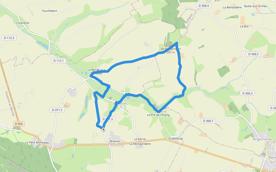
The Altars-Villevillon Introduction
The Altars-Villevillon is a 8.1 mile (19,000-step) route located near Les Autels-Villevillon, Centre-Val de Loire. This route has an elevation gain of about 65.6 ft and is rated as medium. Find the best walking trails near you in Pacer App.
Open in App for Details
Map of The Altars-Villevillon
© Mapbox © OpenStreetMap
View Full Map
View Full Map
Last updated: Mar 1, 2025
Route Details
Length
8.1 mi
Elev. Gain
65.6 ft
Est. Steps
19000
Recommended Routes Near The Altars-Villevillon
La Bazoche-Gouet, Centre-Val de Loire
Rue de la Guinette
Length 0.2 mi
Saint-Ulphace, Pays de la Loire
Grand Pré Road
Length 0.2 mi
Authon-du-Perche, Centre-Val de Loire
Crowned Ox Trail
Length 0.2 mi
Authon-du-Perche, Centre-Val de Loire
Rural Road of Bonhommière and Courtangis
Length 0.3 mi
Authon-du-Perche, Centre-Val de Loire
Path from Saint-Ulphace to Authon
Length 1.1 mi
· Elev 23 ft
Vichères, Centre-Val de Loire
Rougemont hill
Length 4.9 mi
· Elev 252.6 ft
Pacer Walking App
Pacer is the
best walking app
for walking challenges and finding
places to walk near me
.
Open in App for Details
Cancel
Yes
Pacer Walking App
The #1 Walking App
4.8
(1643K)
Open in App
Walking App
Near Me
Walking Clubs
Walking Challenges
Medals
For Workplaces