Pacer Walking App
The #1 Walking App
4.8
(1643K)
Open in App
Walking App
Near Me
Clubs
Challenges
Medals
For Workplaces
© Mapbox
© OpenStreetMap
Improve this map
© Mapbox
© OpenStreetMap
Improve this map
Austria
Obermieming
Via Alpina Red R46
Ehrwald, Tirol
Austria
Obermieming
Via Alpina Red R46
1
reviews
Length
9.6 mi
Elev. Gain
2073 ft
Est. Steps
22000
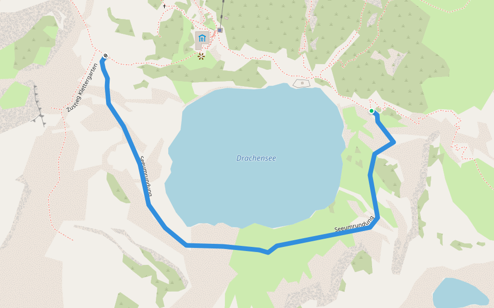
Via Alpina Red R46 Introduction
Via Alpina Red R46 is a 9.6 mile (22,000-step) route located near Ehrwald, Tirol. This route has an elevation gain of about 2073 ft and is rated as hard. Find the best walking trails near you in Pacer App.
Reintalangerhütte - Coburger Hütte
Open in App for Details
Map of Via Alpina Red R46
© Mapbox © OpenStreetMap
View Full Map
View Full Map
Last updated: Mar 1, 2025
Route Details
Length
9.6 mi
Elev. Gain
2073 ft
Est. Steps
22000
Recommended Routes Near Via Alpina Red R46
Biberwier, Tirol
Via Alpina Red R47
Length 7.1 mi
· Elev 3116 ft
Ehrwald, Tirol
Dragon head normal route
Length 0.8 mi
· Elev 826.6 ft
Obermieming, Tirol
Lake circumnavigation
Length 0.5 mi
· Elev 36.1 ft
Ehrwald, Tirol
Approach Tajakante
Length 0.4 mi
· Elev 547.8 ft
Ehrwald, Tirol
Taja Kante via ferrata
Length 0.5 mi
· Elev 1377.6 ft
Ehrwald, Tirol
Sonnenspitzsteig
Length 0.6 mi
· Elev 1253 ft
Pacer Walking App
Pacer is the
best walking app
for walking challenges and finding
places to walk near me
.
Open in App for Details
Cancel
Yes
Pacer Walking App
The #1 Walking App
4.8
(1643K)
Open in App
Walking App
Near Me
Walking Clubs
Walking Challenges
Medals
For Workplaces