Pacer Walking App
The #1 Walking App
4.8
(1643K)
Open in App
Walking App
Near Me
Clubs
Challenges
Medals
For Workplaces
© Mapbox
© OpenStreetMap
Improve this map
© Mapbox
© OpenStreetMap
Improve this map
Italy
Friuli-Venezia Giulia
Prato
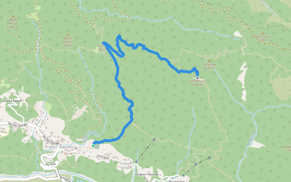
Sentiero Italia - Stage A11
Oseacco, Friuli-Venezia Giulia
Italy
Friuli-Venezia Giulia
Prato
Sentiero Italia - Stage A11
1
reviews
Length
6 mi
Elev. Gain
3063.5 ft
Est. Steps
14000
Sentiero Italia - Stage A11 Introduction
Sentiero Italia - Stage A11 is a 6 mile (14,000-step) route located near Oseacco, Friuli-Venezia Giulia. This route has an elevation gain of about 3063.5 ft and is rated as hard. Find the best walking trails near you in Pacer App.
Open in App for Details
Map of Sentiero Italia - Stage A11
© Mapbox © OpenStreetMap
View Full Map
View Full Map
Last updated: Mar 1, 2025
Route Details
Length
6 mi
Elev. Gain
3063.5 ft
Est. Steps
14000
Recommended Routes Near Sentiero Italia - Stage A11
Chiusaforte, Friuli-Venezia Giulia
Heavenly Way Italy - 8 Prato di Resia - Dogna
Length 7.9 mi
· Elev 1462.9 ft
Friuli-Venezia Giulia
Alpini path n.1
Length 2.1 mi
· Elev 1918.8 ft
Friuli-Venezia Giulia
Path of taste
Length 4.7 mi
· Elev 780.6 ft
Friuli-Venezia Giulia
Claudio Vogric path
Length 4.5 mi
· Elev 3447.3 ft
Friuli-Venezia Giulia
Julius-Kugy-Dreiländerweg in 30 steps - collegamento via E 17b
Length 8.5 mi
· Elev 3631 ft
Stolvizza, Friuli-Venezia Giulia
Route of the Great War
Length 1.8 mi
· Elev 987.3 ft
Pacer Walking App
Pacer is the
best walking app
for walking challenges and finding
places to walk near me
.
Open in App for Details
Cancel
Yes
Pacer Walking App
The #1 Walking App
4.8
(1643K)
Open in App
Walking App
Near Me
Walking Clubs
Walking Challenges
Medals
For Workplaces