Pacer Walking App
The #1 Walking App
4.8
(1.8M)
Open in App
Walking App
Near Me
Clubs
Challenges
Medals
For Workplaces
Try Pacer for Free
© Mapbox
© OpenStreetMap
Improve this map
© Mapbox
© OpenStreetMap
Improve this map
Italy
Friuli-Venezia Giulia
Sonnenalpe Nassfeld
Italy Trail - Stage A06
Friuli-Venezia Giulia
Italy
Friuli-Venezia Giulia
Sonnenalpe Nassfeld
Italy Trail - Stage A06
1
reviews
Length
14.5 mi
Elev. Gain
4027.8 ft
Est. Steps
34000
Italy Trail - Stage A06 Introduction
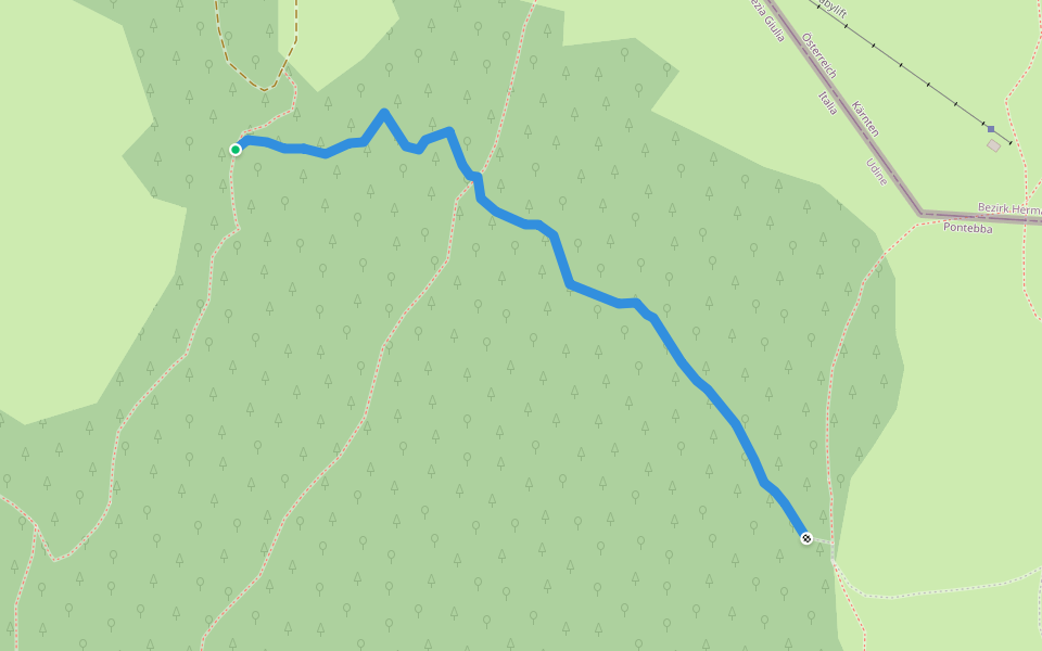
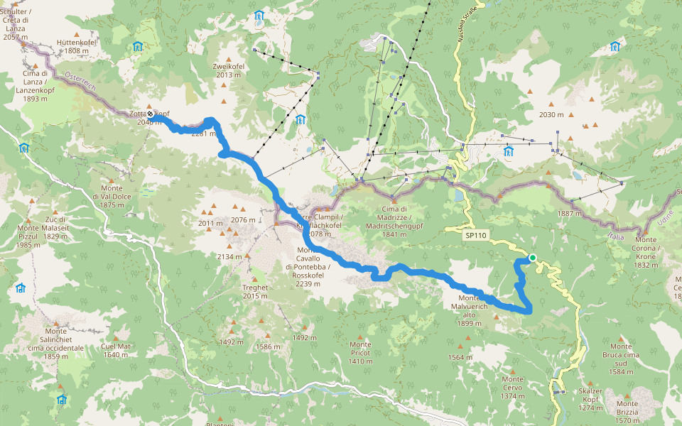
Italy Trail - Stage A06 is a 14.6 mile (34,000-step) route located near Friuli-Venezia Giulia. This route has an elevation gain of about 4027.8 ft and is rated as hard. Find the best walking trails near you in Pacer App.
Open in App for Details
Map of Italy Trail - Stage A06
© Mapbox © OpenStreetMap
View Full Map
View Full Map
Last updated: Sep 1, 2025
Route Details
Length
14.5 mi
Elev. Gain
4027.8 ft
Est. Steps
34000
Recommended Routes Near Italy Trail - Stage A06
Sonnenalpe Nassfeld, Kärnten
(SI A06V1) Passo Pramollo - Egger Alm
Length 9 mi
· Elev 1797.4 ft
Kärnten
Via Alpina Red R19
Length 14.6 mi
· Elev 4788.8 ft
Kärnten
Südalpenweg 03 - Etappe 20
Length 14.6 mi
· Elev 4788.8 ft
Sonnenalpe Nassfeld, Kärnten
Singletrail Chri
Length 0.2 mi
Hermagor-Pressegger See, Carinthia, Austria
Singletrail Italy
Length 4.4 mi
· Elev 1548.2 ft
Kärnten
CAI High Route Pontebba
Length 8.1 mi
· Elev 5526.8 ft
Pacer Walking App
Pacer is the
best walking app
for walking challenges and finding
places to walk near me
.
Start Your Joyful Steps on New Routes
The Best Walking App
1.8M+ 5-star ratings
100M+ global downloads
Scan to download free
Scan QR code with your phone to download
Pacer Walking App
Open in App for Details
Cancel
Yes
Pacer Walking App
The #1 Walking App
4.8
(1.8M)
Open in App
Walking App
Near Me
Walking Clubs
Walking Challenges
Medals
For Workplaces