Pacer Walking App
The #1 Walking App
4.8
(1643K)
Open in App
Walking App
Near Me
Clubs
Challenges
Medals
For Workplaces
Routes
USA
Texas
El Paso
Thunder bird trail
El Paso, Texas, USA
El Paso, Texas, USA
Thunder bird trail
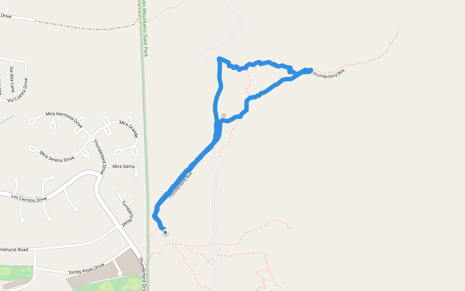
Length
2.5 mi
Elev. Gain
462.5 ft
Est. Steps
6000
Scenic views
Mountain
Created by Alejandro
Thunder bird trail Introduction
Thunder bird trail is a 2.5 mile (6,000-step) route located near El Paso, Texas, USA. This route has an elevation gain of about 462.5 ft and is rated as medium. Find the best walking trails near you in Pacer App.
Open in App for Details
Map of Thunder bird trail
© Mapbox © OpenStreetMap
View Full Map
View Full Map
Last updated: Feb 1, 2025
Route Details
Length
2.5 mi
Elev. Gain
462.5 ft
Est. Steps
6000
Created by
Alejandro
Recommended Routes Near Thunder bird trail
El Paso, Texas, USA
Franklin mountains by Thunderbird
Length 2.2 mi · Elev 701.9 ft
El Paso, Texas
Thunderbird Box
Length 1 mi · Elev 777.4 ft
El Paso, Texas, USA
Franklin Mountains State Park - Thunderbird Box
Length 1.5 mi · Elev 400.2 ft
El Paso, Texas, USA
Franklin Mountains State Park - McKelligon Saddle
Length 1.6 mi · Elev 482.2 ft
El Paso, Texas, USA
Ron Coleman Trail starting at Thunderbird
Length 7.6 mi · Elev 2263.2 ft
El Paso, Texas
McKelligon Saddle
Length 0.6 mi · Elev 370.6 ft
Nearby Parks
Dateland Park
Pacer Walking App
Pacer is the
best walking app
for walking challenges and finding
places to walk near me
.
Open in App for Details
Cancel
Yes
Pacer Walking App
The #1 Walking App
4.8
(1643K)
Open in App
Walking App
Near Me
Walking Clubs
Walking Challenges
Medals
For Workplaces