Pacer Walking App
The #1 Walking App
4.8
(1643K)
Open in App
Walking App
Near Me
Clubs
Challenges
Medals
For Workplaces
© Mapbox
© OpenStreetMap
Improve this map
© Mapbox
© OpenStreetMap
Improve this map
Italy
Closellinaz
Ru path
Roisan, Aosta Valley, Italy
Italy
Closellinaz
Ru path
1
reviews
Length
3.9 mi
Elev. Gain
492 ft
Est. Steps
9000
Ru path Introduction
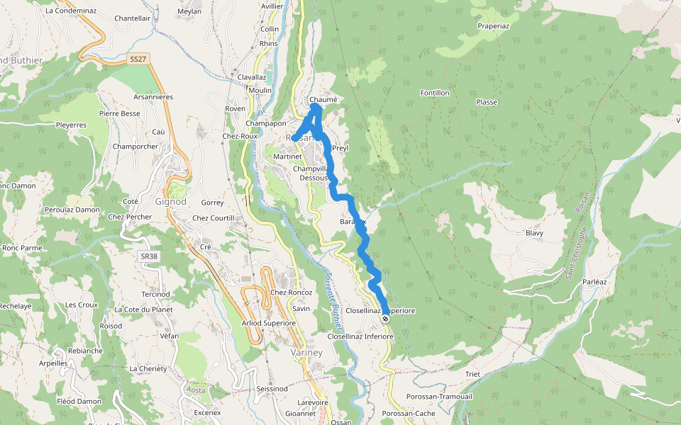
Ru path is a 3.9 mile (9,000-step) route located near Roisan, Aosta Valley, Italy. This route has an elevation gain of about 492 ft and is rated as medium. Find the best walking trails near you in Pacer App.
Open in App for Details
Map of Ru path
© Mapbox © OpenStreetMap
View Full Map
View Full Map
Last updated: Mar 1, 2025
Route Details
Length
3.9 mi
Elev. Gain
492 ft
Est. Steps
9000
Recommended Routes Near Ru path
Valle d'Aosta
Mont Mary
Length 5 mi
· Elev 4316.5 ft
Valle d'Aosta
26b - var Snake
Length 0.4 mi
Valle d'Aosta
Roisan - Riond
Length 2 mi
· Elev 2371.4 ft
Valle d'Aosta
Cammino Balteo (Bassa Via della Valle d'Aosta), Stage 12
Length 8.7 mi
· Elev 3962.2 ft
Gignod, Aosta Valley, Italy
Ru Neuf
Length 3.3 mi
· Elev 88.6 ft
Province of Aosta, Aosta Valley, Italy
Ioc Arsin
Length 2.2 mi
· Elev 305 ft
Pacer Walking App
Pacer is the
best walking app
for walking challenges and finding
places to walk near me
.
Open in App for Details
Cancel
Yes
Pacer Walking App
The #1 Walking App
4.8
(1643K)
Open in App
Walking App
Near Me
Walking Clubs
Walking Challenges
Medals
For Workplaces