Pacer Walking App
The #1 Walking App
4.8
(1643K)
Open in App
Walking App
Near Me
Clubs
Challenges
Medals
For Workplaces
© Mapbox
© OpenStreetMap
Improve this map
© Mapbox
© OpenStreetMap
Improve this map
France
Hauts-de-France
Montdidier
Lateral Path
Montdidier, Somme, France
France
Hauts-de-France
Montdidier
Lateral Path
1
reviews
Length
5 mi
Elev. Gain
836.4 ft
Est. Steps
11000
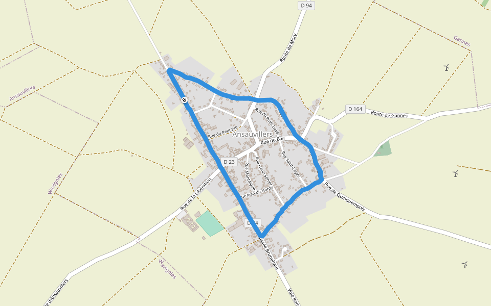
Lateral Path Introduction
Lateral Path is a 5 mile (11,000-step) route located near Montdidier, Somme, France. This route has an elevation gain of about 836.4 ft and is rated as medium. Find the best walking trails near you in Pacer App.
Open in App for Details
Map of Lateral Path
© Mapbox © OpenStreetMap
View Full Map
View Full Map
Last updated: Apr 1, 2025
Route Details
Length
5 mi
Elev. Gain
836.4 ft
Est. Steps
11000
Recommended Routes Near Lateral Path
Montdidier, Hauts-de-France
Side Path
Length 0.2 mi
Montdidier, Hauts-de-France
City Tour Path
Length 0.1 mi
Fignières, Hauts-de-France
The Mountain of Fignières
Length 1.4 mi
· Elev 6.6 ft
Cuvilly, Hauts-de-France
Rue Senez
Length 0.2 mi
Beuvraignes, Somme, France
Marie-Blanche Cross
Length 3.2 mi
Ansauvillers, Oise, France
Ansauvillers
Length 1.8 mi
Pacer Walking App
Pacer is the
best walking app
for walking challenges and finding
places to walk near me
.
Open in App for Details
Cancel
Yes
Pacer Walking App
The #1 Walking App
4.8
(1643K)
Open in App
Walking App
Near Me
Walking Clubs
Walking Challenges
Medals
For Workplaces