Pacer Walking App
The #1 Walking App
4.8
(1643K)
Open in App
Walking App
Near Me
Clubs
Challenges
Medals
For Workplaces
© Mapbox
© OpenStreetMap
Improve this map
© Mapbox
© OpenStreetMap
Improve this map
Australia
New South Wales
Forestville
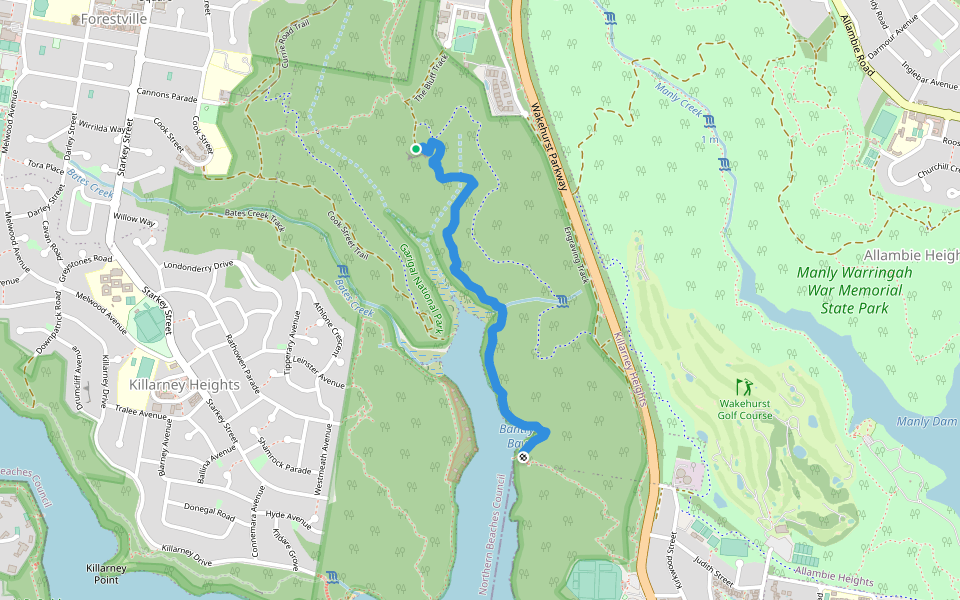
Bates Creek Track
Australia
New South Wales
Forestville
Bates Creek Track
1
reviews
Distância
0.3 km
Passos
420
Detalhes da Rota
Bates Creek Track é uma rota com distância 0.3 km (420-passos) localizada próxima à . Esta rota tem um ganho de elevação de aproximadamente 0 m e é classificada com dificuldade fácil. Encontre mais rotas como esta no App do Pacer.
Abra no App para mais Detalhes
Mapa
© Mapbox © OpenStreetMap
Ver Mapa Inteiro
Ver Mapa Inteiro
Last updated: Mar 1, 2025
Detalhes da Rota
Distância
0.3 km
Passos
420
Rotas Recomendadas
Sydney, Nova Gales do Sul, Austrália
Killarney Heights Oval
Distância 0.7 km
The Bay Track
Distância 1.9 km
· Elev 6 m
Forestville Mall
Distância 0.2 km
ANZAC Memorial Pathway
Distância 0.3 km
Flat Rock Track
Distância 2.3 km
· Elev 33 m
East Lindfield, Nova Gales do Sul
Trilha Two Creeks
Distância 6.6 km
· Elev 84 m
Pacer Walking App
Pacer is the
best walking app
for walking challenges and finding
places to walk near me
.
Abra no App para mais Detalhes
Cancelar
Sim
Pacer Walking App
The #1 Walking App
4.8
(1643K)
Open in App
Walking App
Near Me
Walking Clubs
Walking Challenges
Medals
For Workplaces