CancelYes

Point Reyes National Seashore in Inverness | Map and Routes
Sports Facility · Scrub · Wetland
4.9 (200 ratings)
Discover the natural beauty and diverse landscapes of Point Reyes National Seashore in Inverness, United States, spread across a vast 71864.1 acres. This stunning coastal park offers an array of ...
Discover the natural beauty and diverse landscapes of Point Reyes National Seashore in Inverness, United States, spread across a vast 71864.1 acres. This stunning coastal park offers an array of walking and hiking opportunities, making it a prime destination for outdoor enthusiasts. With an extensive network of trails, including the picturesque Olema Valley Trail and the serene Crystal Lake Trail, visitors can immerse themselves in the tranquil surroundings while engaging in invigorating outdoor activity. Whether you're seeking a leisurely stroll or a challenging hike, Point Reyes National Seashore provides an ideal setting for walkers and hikers of all levels. As you explore Point Reyes National Seashore, you'll encounter a variety of scenic routes that cater to different preferences and abilities. From the 1.1-mile Ocean Lake Loop to the 43-mile ADT - California - T - Seg 9, there's a trail for every adventurer. The park's well-maintained paths and breathtaking vistas create a captivating backdrop for outdoor activity, ensuring a memorable experience for walkers and hikers alike. Whether you're drawn to the coastal landscapes, rolling hills, or tranquil lakes, Point Reyes National Seashore promises a rewarding and enriching journey for nature lovers and outdoor enthusiasts. For those seeking detailed information about the park's walking and hiking routes, the Pacer Pedometer app offers comprehensive insights into the various trails and paths within Point Reyes National Seashore. By downloading the app, users can access valuable data on route lengths, estimated times, and user reviews, empowering them to make informed decisions about their outdoor adventures. Whether you're planning a leisurely walk or a challenging hike, the Pacer Pedometer app serves as a valuable resource for exploring the natural wonders of Point Reyes National Seashore.
View MoreView More
Muddy Hollow Trail, Inverness, CA 94937, USA38.0550° N , -122.8797° W
Directions
Open in App for Detail
Overview
Check-in
Routes
Reviews (6)
Walking and Hiking in Point Reyes National Seashore
Located in the beautiful coastal town of Inverness, the Point Reyes National Seashore offers a plethora of opportunities for walking and hiking enthusiasts. With its diverse landscapes and stunning vistas, this national park is a haven for outdoor enthusiasts seeking adventure and natural beauty. Whether you are a seasoned hiker ...
Located in the beautiful coastal town of Inverness, the Point Reyes National Seashore offers a plethora of opportunities for walking and hiking enthusiasts. With its diverse landscapes and stunning vistas, this national park is a haven for outdoor enthusiasts seeking adventure and natural beauty. Whether you are a seasoned hiker or a leisurely walker, Point Reyes National Seashore has something to suit everyone's needs. From well-maintained trails to accessible amenities, this park is the ideal destination for a memorable outdoor experience. With amenities such as wheelchair-friendly paths, numerous parking lots, picnic sites, restrooms, and drinking water stations, visitors can enjoy their walking or hiking activities with ease and convenience. The park also boasts sports facilities like a baseball court, swimming pool, and horse riding opportunities, adding an extra dimension to the outdoor experience. In addition to the physical activities, visitors can explore various points of interest, including the historic USCG Boathouse, whale watch points, elephant seal overlook, Tule Elk Reserve, and the picturesque Cypress Tree Tunnel. For those seeking a break, the park offers restaurants and shelters, making it a well-rounded destination for a day of walking and hiking. Whether you're interested in leisurely strolls or challenging treks, Point Reyes National Seashore in Inverness promises a fulfilling experience amidst breathtaking natural surroundings.
View MoreView MoreOther Info about Point Reyes National Seashore
Essential Amenities in Point Reyes National Seashore
Point Reyes National Seashore Sport Facilities
Accessibility in Point Reyes National Seashore
Things to See in Point Reyes National Seashore
Attraction
Kule Loklo
Attraction
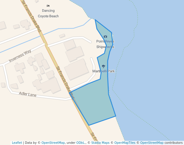
Point Reyes Shipwrecks
Attraction
Tule Elk Reserve, Pierce Pt., Pt. Reyes NS
Attraction
Cypress Tree Tunnel
Viewpoint
whale watch point
Viewpoint
Elephant Seal Overlook
Viewpoint
Observatory
Viewpoint
Point Reyes, Whales Observation Point
Viewpoint
Arch Rock
Museum
Historic USCG Boathouse
Memorial
Francis Drake memorial
Memorial
Golden Hinde landing
Memorial
Point Reyes National Seashore dedication plaque
Monument
Point Reyes Lifeboat Station
Monument
Francis Drake
Other Amenities in Point Reyes National Seashore
Shelter
Restaurant
Bicycle parking
Best Walking Routes in Point Reyes National Seashore
#1 - Kelham Beach - Coast Trail
3
Length: 1.5 milesEst. Time: 26m
Kelham Beach - Coast Trail is a 1.5 mile (3,500-step) route located near Point Reyes Station, California, USA. This route has an elevation gain of about 223 ft and is rated as medium. Find the best walking trails near you in Pacer App.
#2 - Sir Francis Drake Boulevard
1
Length: 0.4 milesEst. Time: 6m
Sir Francis Drake Boulevard is a 0.4 mile (1,000-step) route located near Inverness, California. This route has an elevation gain of about 0 ft and is rated as easy. Find the best walking trails near you in Pacer App.
#3 - Earthquake Trail
1
Length: 0.5 milesEst. Time: 9m
Earthquake Trail is a 0.5 mile (1,500-step) route located near Point Reyes Station, California. This route has an elevation gain of about 0 ft and is rated as easy. Find the best walking trails near you in Pacer App.
See All Routes
See All Routes
Point Reyes National Seashore Leaderboard
RankingCheck-ins
4
65
46
47
48
39
210
2*Leaderboard only shows top 10 users. Only public activities are eligible for leaderboards. For any one park, a user can only check-in a maximum of once per day.
Nearby Parks
FAQs About Point Reyes National Seashore
Where is the best place to walk in Point Reyes National Seashore?
The best place to walk in Point Reyes National Seashore is the Olema Valley Trail. It is a 5.3-mile trail with a 4-star rating and positive reviews. It offers a beautiful natural setting and a moderate level of difficulty, making it a popular choice for walkers and hikers. (Routes info provided by the Pacer community)
How many routes are in Point Reyes National Seashore?
Point Reyes National Seashore offers a total of 6 routes for walking and hiking. Each route provides a unique experience and varying levels of difficulty, catering to different preferences and fitness levels. (Routes info provided by the Pacer community)
Which is the longest route in Point Reyes National Seashore?
The longest route in Point Reyes National Seashore is the ADT - California - T - Seg 9, which spans 43 miles. This route is recommended for experienced hikers and offers a challenging yet rewarding trek through the park's diverse landscapes. (Routes info provided by the Pacer community)
Are there facilities or amenities for walkers/hikers in Point Reyes National Seashore?
Yes, there are several amenities for walkers and hikers in Point Reyes National Seashore, including parking lots, picnic sites, restrooms, drinking water stations, and wheelchair-friendly facilities.
How accessible is Point Reyes National Seashore?
Point Reyes National Seashore is wheelchair-friendly, providing accessibility for individuals with mobility challenges.
What kind of sports can I do in Point Reyes National Seashore?
While primarily known for walking and hiking, Point Reyes National Seashore also offers horse riding facilities for visitors who are interested in exploring the park on horseback.
What is the best season to walk in Point Reyes National Seashore?
The best season for walking in Point Reyes National Seashore is typically late spring to early fall, when the weather is mild and the park's stunning coastal scenery can be fully enjoyed.
What are the typical weather conditions to prepare for in Point Reyes National Seashore?
Point Reyes National Seashore experiences a maritime climate with cool, foggy summers and mild, wet winters. Visitors should be prepared for changing weather conditions, including fog and wind, especially along the coastline.
What kind of wildlife might you encounter in Point Reyes National Seashore?
Visitors to Point Reyes National Seashore may encounter a diverse range of wildlife, including Tule elk, deer, coyotes, and a variety of bird species. Marine life such as seals and sea lions can also be spotted along the coastline.
Last updated: Mar 18, 2025
Parks Near Point Reyes National Seashore