CancelYes

Phillip Burton Wilderness Area in Point Reyes Station | Map and Routes
Pond · Beach
4.8 (124 ratings)
Discover the natural beauty of the Phillip Burton Wilderness Area in Point Reyes Station, United States. With 23,719.4 acres of pristine wilderness, this park offers an ideal setting for walkers ...
Discover the natural beauty of the Phillip Burton Wilderness Area in Point Reyes Station, United States. With 23,719.4 acres of pristine wilderness, this park offers an ideal setting for walkers and hikers seeking an immersive outdoor experience. The park boasts a variety of well-maintained trails suitable for all skill levels, providing an excellent opportunity to explore the diverse landscapes and wildlife. Whether you're looking for a leisurely stroll or a more challenging hike, this park has something for everyone to enjoy. As you embark on your adventure, be sure to take in the breathtaking views and immerse yourself in the tranquility of this remarkable wilderness. Embark on a memorable outdoor activity at the Phillip Burton Wilderness Area in Point Reyes Station. With an extensive network of trails, including the popular Olema Valley Trail and Crystal Lake Trail, walkers and hikers can choose from a range of options to suit their preferences. The park offers routes of varying lengths, from the scenic Ocean Lake Loop to the more challenging ADT - California - T - Seg 9, ensuring that visitors can find the perfect trail for their desired experience. Whether you're seeking a quick nature walk or a full-day hiking adventure, this park provides the ideal backdrop for your outdoor pursuits. For those interested in exploring the Phillip Burton Wilderness Area in Point Reyes Station further, consider downloading Pacer Pedometer for additional information about the park's routes and trail options. Whether you're a seasoned hiker or a casual walker, this valuable resource can enhance your outdoor experience by providing detailed insights into the park's offerings. From the tranquility of Lake Ranch Trail to the rugged beauty of Old Out Road, there's no shortage of opportunities to immerse yourself in the natural wonders of this captivating wilderness area.
View MoreView More
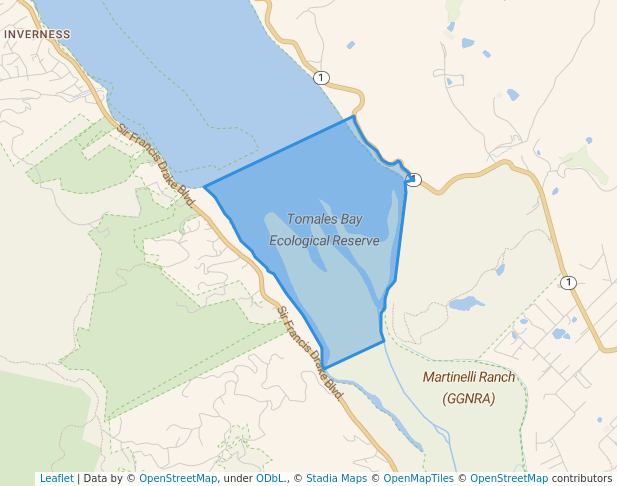
Fire Ln Trail, Point Reyes Station, CA 94956, USA38.0353° N , -122.8402° W
Directions
Open in App for Detail
Overview
Check-in
Routes
Reviews (4)
Walking and Hiking in Phillip Burton Wilderness Area
Located in the picturesque Point Reyes Station, the Phillip Burton Wilderness Area offers an abundance of opportunities for walking and hiking enthusiasts. With essential amenities such as restrooms and drinking water, visitors can embark on their outdoor adventures with ease. The park boasts captivating viewpoints, including the whale watch point, ...
Located in the picturesque Point Reyes Station, the Phillip Burton Wilderness Area offers an abundance of opportunities for walking and hiking enthusiasts. With essential amenities such as restrooms and drinking water, visitors can embark on their outdoor adventures with ease. The park boasts captivating viewpoints, including the whale watch point, observatory, and Arch Rock, providing stunning vistas for hikers to enjoy. Additionally, bicycle parking is available for those who prefer cycling as part of their outdoor activity. Whether you are seeking a leisurely walk or a challenging hike, the Phillip Burton Wilderness Area in Point Reyes Station is the ideal destination to immerse yourself in the beauty of nature and engage in invigorating outdoor activities.
View MoreView MoreOther Info about Phillip Burton Wilderness Area
HoursOpen 24 hours
Essential Amenities in Phillip Burton Wilderness Area
Things to See in Phillip Burton Wilderness Area
Viewpoint
whale watch point
Viewpoint
Observatory
Viewpoint
Arch Rock
Other Amenities in Phillip Burton Wilderness Area
Bicycle parking
Best Walking Routes in Phillip Burton Wilderness Area
#1 - Kelham Beach - Coast Trail
3
Length: 1.5 milesEst. Time: 26m
Kelham Beach - Coast Trail is a 1.5 mile (3,500-step) route located near Point Reyes Station, California, USA. This route has an elevation gain of about 223 ft and is rated as medium. Find the best walking trails near you in Pacer App.

#2 - Mount Wittenberg Trail
1
Length: 2 milesEst. Time: 35m
Mount Wittenberg Trail is a 2 mile (4,500-step) route located near Point Reyes Station, California. This route has an elevation gain of about 3.3 ft and is rated as easy. Find the best walking trails near you in Pacer App.
#3 - Wittenberg Summit
1
Length: 0.3 milesEst. Time: 4m
Wittenberg Summit is a 0.3 mile (500-step) route located near Point Reyes Station, California. This route has an elevation gain of about 0 ft and is rated as easy. Find the best walking trails near you in Pacer App.
See All Routes
See All Routes
Phillip Burton Wilderness Area Leaderboard
RankingCheck-ins
4
35
36
27
28
29
210
2*Leaderboard only shows top 10 users. Only public activities are eligible for leaderboards. For any one park, a user can only check-in a maximum of once per day.
Nearby Parks
FAQs About Phillip Burton Wilderness Area
Where is the best place to walk in Phillip Burton Wilderness Area?
The best place to walk in Phillip Burton Wilderness Area is the Olema Valley Trail, which is a 5.3-mile trail with a rating of 4.0. It offers beautiful scenery and is well-rated by the Pacer community for its hiking experience.
How many routes are in Phillip Burton Wilderness Area?
Phillip Burton Wilderness Area has a total of six routes for walking and hiking.
Which is the longest route in Phillip Burton Wilderness Area?
The longest route in Phillip Burton Wilderness Area is the ADT - California - T - Seg 9, which is a 43-mile trail. It offers a challenging and rewarding hiking experience, as reviewed by the Pacer community.
Are there facilities or amenities for walkers/hikers in Phillip Burton Wilderness Area?
Yes, there are essential amenities such as restrooms and drinking water available for walkers and hikers in the Phillip Burton Wilderness Area.
How accessible is Phillip Burton Wilderness Area?
Phillip Burton Wilderness Area is accessible for walkers and hikers, with essential amenities and viewpoints available for visitors to enjoy.
What kind of sports can I do in Phillip Burton Wilderness Area?
In addition to walking and hiking, visitors can also enjoy sports like cycling, with bicycle parking available in the park.
What is the best season to walk in Phillip Burton Wilderness Area?
The best season to walk in Phillip Burton Wilderness Area is typically in the spring and fall when the weather is milder, and the wildflowers are in bloom. It's also less crowded during these seasons.
What are the typical weather conditions to prepare for in Phillip Burton Wilderness Area?
Phillip Burton Wilderness Area experiences a maritime climate with cool, foggy summers and mild, wet winters. Walkers and hikers should be prepared for variable weather, including fog, wind, and occasional rain. It's advisable to dress in layers and carry waterproof gear.
What kind of wildlife might you encounter in Phillip Burton Wilderness Area?
Phillip Burton Wilderness Area is home to a diverse range of wildlife, including Tule elk, deer, coyotes, and a variety of bird species. Visitors should also be aware of the presence of snakes, such as the northern Pacific rattlesnake, and take precautions while walking or hiking.
Last updated: Mar 18, 2025
Parks Near Phillip Burton Wilderness Area