CancelYes


Turkey Point Provincial Park in Turkey Point | Map and Routes
Sports Facility · Forest
5 (27 ratings)
Turkey Point Provincial Park, located in Turkey Point, Canada, is a picturesque destination spread across 781.0 acres, offering a wide range of activities for walkers and hikers. With its diverse ...
Turkey Point Provincial Park, located in Turkey Point, Canada, is a picturesque destination spread across 781.0 acres, offering a wide range of activities for walkers and hikers. With its diverse landscape and well-maintained trails, the park provides an ideal setting for outdoor enthusiasts to indulge in walking and hiking adventures. Visitors can explore a variety of routes, including the popular 'Fin & Feather' trail, which spans 0.9 miles and provides a scenic and enjoyable walking experience. Whether you're seeking a leisurely stroll or a more challenging hike, Turkey Point Provincial Park has something to suit every level of activity, making it a must-visit for nature lovers and outdoor enthusiasts. For more detailed park and route information, users can download Pacer Pedometer, an app that offers comprehensive insights into parks and routes. As you venture into Turkey Point Provincial Park, you'll discover a network of well-marked trails that cater to different preferences and abilities. The 'Spinal Tap,' 'Fox on the Run,' and 'Wedowmaker' trails, each spanning approximately 0.7 miles, are ideal for those seeking a moderately paced walking experience with captivating natural surroundings. Additionally, the 'Humpback' trail, measuring 0.6 miles, offers a shorter yet equally rewarding route for walkers and hikers. Whether you're looking to enjoy a leisurely walk or engage in a brisk hike, the park's diverse trail options ensure that there's always an exciting and fulfilling activity awaiting you amidst the beautiful natural landscape of Turkey Point Provincial Park. Turkey Point Provincial Park in Turkey Point, Canada, is a haven for outdoor enthusiasts seeking to immerse themselves in the serene beauty of nature while engaging in walking and hiking activities. With its expansive acreage and numerous well-maintained trails, the park provides an idyllic setting for individuals and groups to partake in leisurely walks or invigorating hikes. The park's commitment to offering a variety of routes, such as the 'Fin & Feather' trail and others, ensures that visitors can tailor their experiences to their desired level of activity and enjoyment. Whether you're an avid hiker or simply looking for a peaceful stroll, Turkey Point Provincial Park is a destination that promises unforgettable outdoor adventures amidst breathtaking natural surroundings. For detailed information on park routes and amenities, users can download Pacer Pedometer, a valuable resource for exploring parks and trails.
View MoreView More
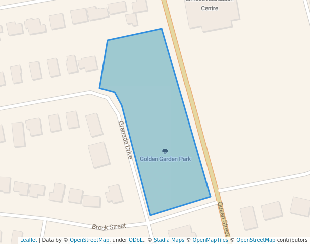
Turkey Point Provincial Pk Entry, Norfolk, ON N0E 1T0, Canada42.7027° N , -80.3331° W
Directions
Open in App for Detail
Overview
Check-in
Routes
Photos (3)
Walking and Hiking in Turkey Point Provincial Park
If you're a walking or hiking enthusiast looking for a picturesque and invigorating experience, Turkey Point Provincial Park in Turkey Point, Canada, is the perfect destination for you. This stunning park offers essential amenities such as parking lots, restrooms, and drinking water, ensuring that your outdoor adventure is comfortable and ...
If you're a walking or hiking enthusiast looking for a picturesque and invigorating experience, Turkey Point Provincial Park in Turkey Point, Canada, is the perfect destination for you. This stunning park offers essential amenities such as parking lots, restrooms, and drinking water, ensuring that your outdoor adventure is comfortable and convenient. Additionally, the park features a golf course, providing the opportunity for a round of golf amidst the natural beauty. With its abundant showers, you can freshen up after a day of outdoor activity. Whether you prefer a leisurely walk or a challenging hike, the diverse trails at Turkey Point Provincial Park cater to all levels of outdoor enthusiasts. The scenic landscapes and tranquil surroundings make it an ideal location for walkers and hikers seeking an immersive experience in nature. So, lace up your hiking boots and get ready to explore the wonders of Turkey Point Provincial Park!
View MoreView MoreOther Info about Turkey Point Provincial Park
Essential Amenities in Turkey Point Provincial Park
Turkey Point Provincial Park Sport Facilities
Other Amenities in Turkey Point Provincial Park
Shower
Best Walking Routes in Turkey Point Provincial Park
#1 - Saudwinder
1
Length: 0.9 milesEst. Time: 15m
Saudwinder is a 0.9 mile (2,000-step) route located near Normandale, Ontario. This route has an elevation gain of about 9.8 ft and is rated as easy. Find the best walking trails near you in Pacer App.

#2 - Dizzy Lizzy
1
Length: 1.4 milesEst. Time: 23m
Dizzy Lizzy is a 1.4 mile (3,000-step) route located near Normandale, Ontario. This route has an elevation gain of about 16.4 ft and is rated as easy. Find the best walking trails near you in Pacer App.

#3 - Big Mike
1
Length: 1.1 milesEst. Time: 18m
Big Mike is a 1.1 mile (2,500-step) route located near Normandale, Ontario. This route has an elevation gain of about 3.3 ft and is rated as easy. Find the best walking trails near you in Pacer App.
See All Routes
See All Routes
Turkey Point Provincial Park Leaderboard
RankingCheck-ins
4
35
26
27
18
19
110
1*Leaderboard only shows top 10 users. Only public activities are eligible for leaderboards. For any one park, a user can only check-in a maximum of once per day.
Nearby Parks
FAQs About Turkey Point Provincial Park
Where is the best place to walk in Turkey Point Provincial Park?
The best place to walk in Turkey Point Provincial Park is on the 'Fin & Feather' trail. It has a rating of 4.0 and offers a scenic 0.9-mile walk, which should take about 15 minutes. This information is based on the Pacer community's route reviews and ratings.
How many routes are in Turkey Point Provincial Park?
Turkey Point Provincial Park offers a variety of routes for walkers and hikers. There are five routes available: 'Fin & Feather', 'Spinal Tap', 'Fox on the Run', 'Wedowmaker', and 'Humpback'. Each route provides a unique experience for visitors based on the Pacer community's route information.
Which is the longest route in Turkey Point Provincial Park?
The longest route in Turkey Point Provincial Park is the 'Fin & Feather' trail, which spans 0.9 miles. It offers a longer and more immersive walking experience compared to the other routes available in the park. This information is based on the Pacer community's route reviews and ratings.
Are there facilities or amenities for walkers/hikers in Turkey Point Provincial Park?
Yes, there are essential amenities such as parking lots, restrooms, and drinking water available throughout the park for the convenience of walkers and hikers.
How accessible is Turkey Point Provincial Park?
Turkey Point Provincial Park is easily accessible with well-maintained parking lots, making it convenient for visitors to access the park and enjoy its natural beauty.
What kind of sports can I do in Turkey Point Provincial Park?
In addition to walking and hiking, visitors can also enjoy golfing at the golf course available within Turkey Point Provincial Park.
What is the best season to walk in Turkey Point Provincial Park?
The best season to walk in Turkey Point Provincial Park is typically spring or fall when the weather is mild and the foliage is vibrant.
What are the typical weather conditions to prepare for in Turkey Point Provincial Park?
Visitors to Turkey Point Provincial Park should prepare for hot and humid summers, with temperatures reaching up to 30°C (86°F), and cold winters with occasional snowfall and temperatures dropping to -10°C (14°F).
What kind of wildlife might you encounter in Turkey Point Provincial Park?
In Turkey Point Provincial Park, visitors may encounter white-tailed deer, wild turkeys, various bird species, and small mammals such as raccoons and squirrels. It's important to be aware of the presence of these animals and respect their natural habitat.
Last updated: Mar 1, 2025
Parks Near Turkey Point Provincial Park