Pacer Walking App
The #1 Walking App
4.8
(1643K)
Open in App
Walking App
Near Me
Clubs
Challenges
Medals
For Workplaces
© Mapbox
© OpenStreetMap
Improve this map
© Mapbox
© OpenStreetMap
Improve this map
United States
New Hampshire
Moultonborough
마운트 로버츠 트레일
Moultonborough, 뉴햄프셔 주, 미국
United States
New Hampshire
Moultonborough
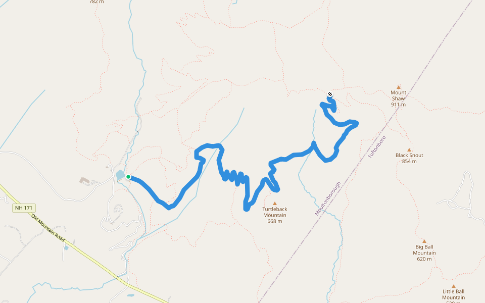
마운트 로버츠 트레일
1
평가
길이
3.8 km
고도 높이기
245 m
단계
5500
루트 디테일
마운트 로버츠 트레일은/는 3.8 km (5,500-걸음) Moultonborough, 뉴햄프셔 주, 미국주변 입니다. 이 루트의 경도는 대략 245 m 정도이며, 별점어려움 점을 받았습니다. 이것과 비슷한 루트를 Pacer 앱 에서 찾아보세요!!
자세한 내용은 앱에서 열기
지도
© Mapbox © OpenStreetMap
전체 지도 보기
전체 지도 보기
평가
4.5
(1)
kendraellertson
2020/05/30
Last updated: Mar 1, 2025
루트 디테일
길이
3.8 km
고도 높이기
245 m
단계
5500
추천 루트
Moultonborough, 뉴햄프셔 주, 미국
마운트 로버츠 트레일
길이 8.2 km
· 경도 481 m
Mount Roberts Trail
길이 3.7 km
· 경도 349 m
Cold Spring Tail
길이 1.9 km
· 경도 10 m
Turtleback Mountain Trail
길이 8 km
· 경도 349 m
Brook Walk Trail
길이 1 km
Shannon Brook Trail (closed)
길이 0.5 km
Pacer Walking App
Pacer is the
best walking app
for walking challenges and finding
places to walk near me
.
자세한 내용은 앱에서 열기
취소
예
Pacer Walking App
The #1 Walking App
4.8
(1643K)
Open in App
Walking App
Near Me
Walking Clubs
Walking Challenges
Medals
For Workplaces