Pacer Walking App
The #1 Walking App
4.8
(1643K)
Open in App
Walking App
Near Me
Clubs
Challenges
Medals
For Workplaces
© Mapbox
© OpenStreetMap
Improve this map
© Mapbox
© OpenStreetMap
Improve this map
France
Centre-Val de Loire
Les Autels-Villevillon
祭壇-ヴィルヴィヨン
レ オーテル ヴィルヴィヨン, サントル ヴァル ド ロワール
France
Centre-Val de Loire
Les Autels-Villevillon
祭壇-ヴィルヴィヨン
1
评価
長さ
13 km
高さの変化
20 m
ステップ
19000
ルート詳細
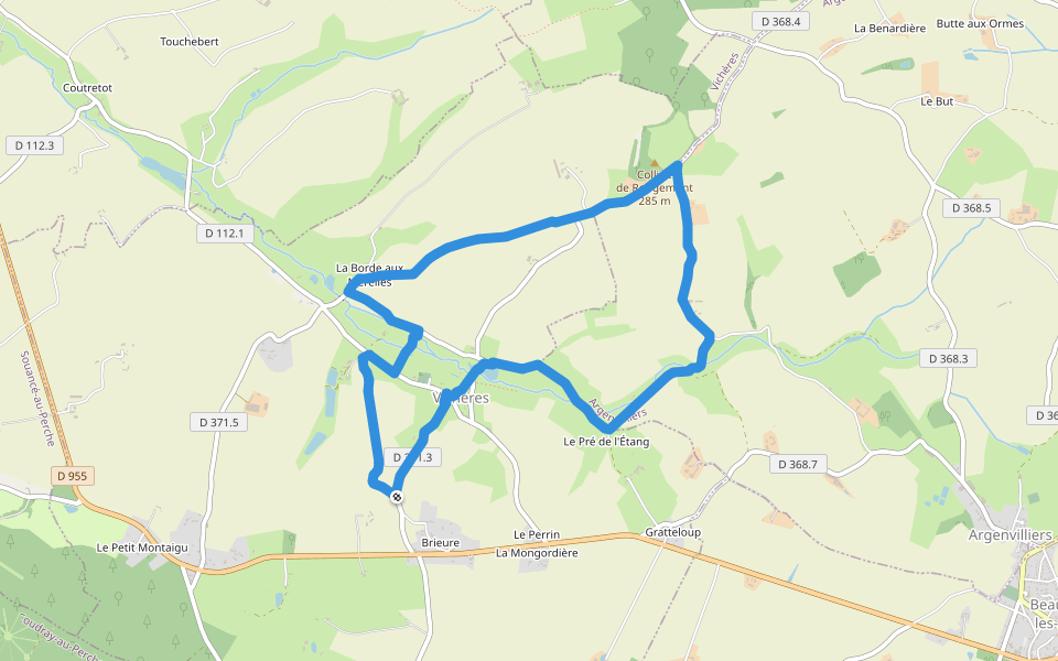
「祭壇-ヴィルヴィヨン」はレ オーテル ヴィルヴィヨン, サントル ヴァル ド ロワール周辺にある13 km(19,000歩)のルートです。このルートの獲得標高はおよそ20 mで、難易度は普通とされています。これに似たルートはPacerアプリからご覧ください。
詳細をアプリで開く
地図
© Mapbox © OpenStreetMap
全体の地図を見る
全体の地図を見る
Last updated: Apr 1, 2025
ルート詳細
長さ
13 km
高さの変化
20 m
ステップ
19000
おすすめルート
Rue de la Guinette
長さ 0.2 km
Chemin du Grand Pré
長さ 0.4 km
Sentier du Boeuf Couronné
長さ 0.3 km
Chemin Rural de la Bonhommière et la Courtangis
長さ 0.5 km
Chemin de Saint-Ulphace à Authon
長さ 1.7 km
· 海抜 7 m
ビシェール, サントル ヴァル ド ロワール
ルージュモンの丘
長さ 7.8 km
· 海抜 77 m
Pacer Walking App
Pacer is the
best walking app
for walking challenges and finding
places to walk near me
.
詳細をアプリで開く
キャンセル
はい
Pacer Walking App
The #1 Walking App
4.8
(1643K)
Open in App
Walking App
Near Me
Walking Clubs
Walking Challenges
Medals
For Workplaces