Pacer Walking App
The #1 Walking App
4.8
(1643K)
Open in App
Walking App
Near Me
Clubs
Challenges
Medals
For Workplaces
© Mapbox
© OpenStreetMap
Improve this map
© Mapbox
© OpenStreetMap
Improve this map
France
Auvergne-Rhône-Alpes
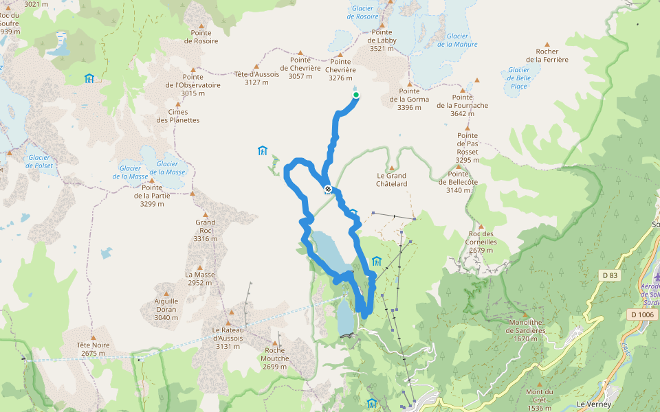
Pralognan-la-Vanoise
Sentier du Col de Chavière
France
Auvergne-Rhône-Alpes
Pralognan-la-Vanoise
Sentier du Col de Chavière
1
reviews
Lunghezza
1 km
passi
1500
Dettagli Percorso
Sentier du Col de Chavièreè un 1 km(1.500-passi) percorso localizzato vicino a .Questo percorso ha unelevazione di circa 0 m ed è classificato con facile. Trova nuovi percorsi come questo nellApp Pacer.
Apri nell'App per Dettagli
Carta geografica
© Mapbox © OpenStreetMap
Vedi Mappa Intera
Vedi Mappa Intera
Last updated: Mar 1, 2025
Dettagli Percorso
Lunghezza
1 km
passi
1500
Percorsi Raccomandati
Aussois, Alvernia-Rodano-Alpi
Lago Genepì
Lunghezza 12 km
· Elev 553 m
Les Allues, Savoia, Francia
Roc du Sulphur
Lunghezza 12.1 km
· Elev 680 m
Plein Sud
Lunghezza 0.4 km
Rue de Caron
Lunghezza 0.3 km
Villarodin-Bourget, Alvernia-Rodano-Alpi
Valle dell'Orgere
Lunghezza 4 km
· Elev 171 m
DH de Chatalamia
Lunghezza 1.9 km
Pacer Walking App
Pacer is the
best walking app
for walking challenges and finding
places to walk near me
.
Apri nell'App per Dettagli
Annulla
Si
Pacer Walking App
The #1 Walking App
4.8
(1643K)
Open in App
Walking App
Near Me
Walking Clubs
Walking Challenges
Medals
For Workplaces