Pacer Walking App
The #1 Walking App
4.8
(1643K)
Open in App
Walking App
Near Me
Clubs
Challenges
Medals
For Workplaces
© Mapbox
© OpenStreetMap
Improve this map
© Mapbox
© OpenStreetMap
Improve this map
France
Centre-Val de Loire
Les Autels-Villevillon
Gli Altari-Villevillon
Les Autels-Villevillon, Centre-Val de Loire
France
Centre-Val de Loire
Les Autels-Villevillon
Gli Altari-Villevillon
1
reviews
Lunghezza
13 km
Altezza Raggiunta
20 m
passi
19000
Dettagli Percorso
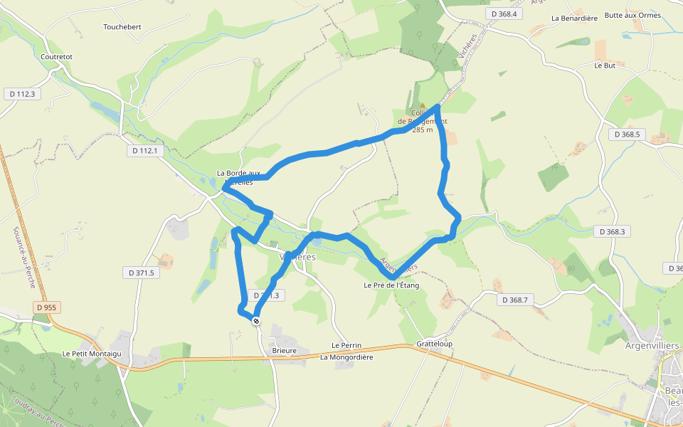
Gli Altari-Villevillonè un 13 km(19.000-passi) percorso localizzato vicino a Les Autels-Villevillon, Centre-Val de Loire.Questo percorso ha unelevazione di circa 20 m ed è classificato con medio. Trova nuovi percorsi come questo nellApp Pacer.
Apri nell'App per Dettagli
Carta geografica
© Mapbox © OpenStreetMap
Vedi Mappa Intera
Vedi Mappa Intera
Last updated: Mar 1, 2025
Dettagli Percorso
Lunghezza
13 km
Altezza Raggiunta
20 m
passi
19000
Percorsi Raccomandati
Rue de la Guinette
Lunghezza 0.2 km
Chemin du Grand Pré
Lunghezza 0.4 km
Sentier du Boeuf Couronné
Lunghezza 0.3 km
Chemin Rural de la Bonhommière et la Courtangis
Lunghezza 0.5 km
Chemin de Saint-Ulphace à Authon
Lunghezza 1.7 km
· Elev 7 m
Vichères, Centre-Val de Loire
Collina di Rougemont
Lunghezza 7.8 km
· Elev 77 m
Pacer Walking App
Pacer is the
best walking app
for walking challenges and finding
places to walk near me
.
Apri nell'App per Dettagli
Annulla
Si
Pacer Walking App
The #1 Walking App
4.8
(1643K)
Open in App
Walking App
Near Me
Walking Clubs
Walking Challenges
Medals
For Workplaces