Pacer Walking App
The #1 Walking App
4.8
(1643K)
Open in App
Walking App
Near Me
Clubs
Challenges
Medals
For Workplaces
© Mapbox
© OpenStreetMap
Improve this map
© Mapbox
© OpenStreetMap
Improve this map
Italy
Motrone
Via di Motrone
Italy
Motrone
Via di Motrone
1
reviews
Longueur
0.2 km
Gain de Hauteur
40 m
Pas
340
Détails de l'itinéraire
Via di Motrone est un itinéraire 0.2 km (340pas) localisé près de . Cet itinéraire a un gain de hauteur autour de 40 m et est classé difficile. Trouvez plus ditinéraires comme celui-ci sur lApp Pacer.
Ouvrir dans l'App pour les détails
Carte
© Mapbox © OpenStreetMap
Voir la carte
Voir la carte
Last updated: Mar 1, 2025
Détails de l'itinéraire
Longueur
0.2 km
Gain de Hauteur
40 m
Pas
340
Itinéraires recommandés
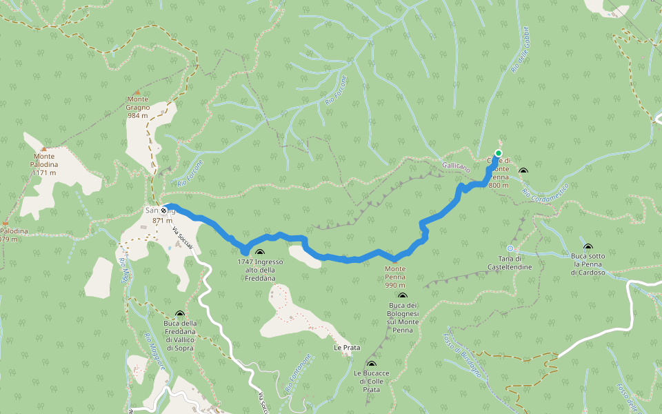
Fabbriche de Vergemoli, Toscane
La Piazzola (chemin 136) - Tana di Casteltendine - La Scaletta - Vallico di Sopra - San Luigi (croisement chemin 136) - Monte Palodina - Foce Palodina (chemin 136)
Longueur 5.8 km
· Hauteur 623 m
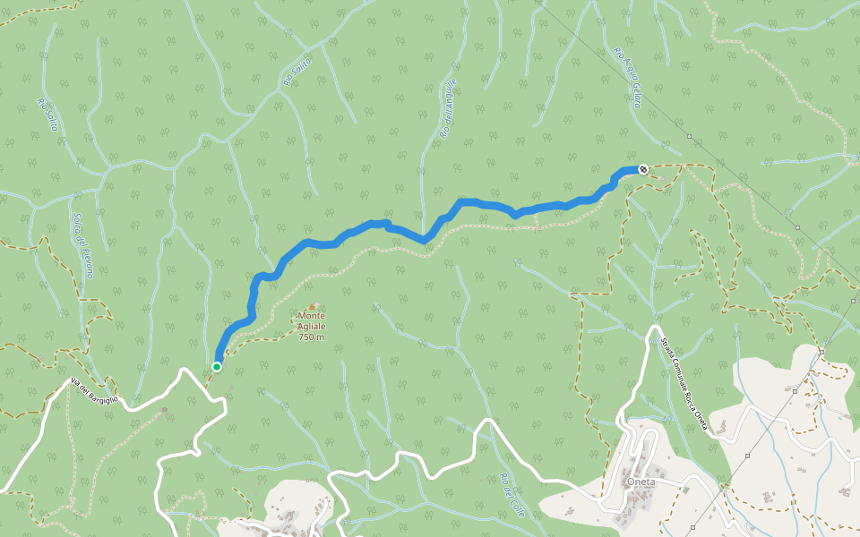
Vallée de Sopra, Toscane
La Croix – Monte Penna – S. Luigi
Longueur 2.3 km
· Hauteur 195 m
Tagliata di S.Cristina
Longueur 2.2 km
· Hauteur 131 m
Via David Camilli
Longueur 0.2 km
sentiero Tigliora
Longueur 3 km
variante sentiero Tigliora
Longueur 0.2 km
Pacer Walking App
Pacer is the
best walking app
for walking challenges and finding
places to walk near me
.
Ouvrir dans l'App pour les détails
Annuler
Oui
Pacer Walking App
The #1 Walking App
4.8
(1643K)
Open in App
Walking App
Near Me
Walking Clubs
Walking Challenges
Medals
For Workplaces