Pacer Walking App
The #1 Walking App
4.8
(1643K)
Open in App
Walking App
Near Me
Clubs
Challenges
Medals
For Workplaces
© Mapbox
© OpenStreetMap
Improve this map
© Mapbox
© OpenStreetMap
Improve this map
Denmark
North Denmark Region
Thisted
La route de Vilsbøl
Thisted
Denmark
North Denmark Region
Thisted
La route de Vilsbøl
1
reviews
Longueur
7.1 km
Gain de Hauteur
34 m
Pas
10000
Détails de l'itinéraire
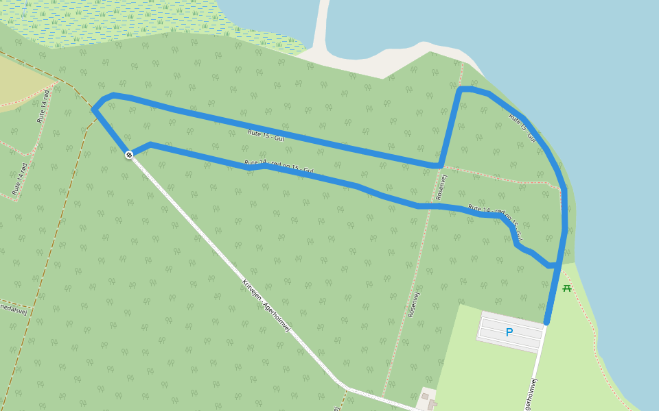
La route de Vilsbøl est un itinéraire 7.1 km (10 000pas) localisé près de Thisted. Cet itinéraire a un gain de hauteur autour de 34 m et est classé facile. Trouvez plus ditinéraires comme celui-ci sur lApp Pacer.
Ouvrir dans l'App pour les détails
Carte
© Mapbox © OpenStreetMap
Voir la carte
Voir la carte
Last updated: Mar 1, 2025
Détails de l'itinéraire
Longueur
7.1 km
Gain de Hauteur
34 m
Pas
10000
Itinéraires recommandés
Rute 15 - Gul
Longueur 1.3 km
· Hauteur 8 m
Thisted
Nebelruten
Longueur 2.5 km
· Hauteur 7 m
Rosenvej
Longueur 0.5 km
Thisted
La route d'Årbjer
Longueur 2.1 km
· Hauteur 13 m
Rute 14 - rød og 15 - Gul
Longueur 0.9 km
· Hauteur 3 m
Thisted
Le parcours du trou
Longueur 0.9 km
Pacer Walking App
Pacer is the
best walking app
for walking challenges and finding
places to walk near me
.
Ouvrir dans l'App pour les détails
Annuler
Oui
Pacer Walking App
The #1 Walking App
4.8
(1643K)
Open in App
Walking App
Near Me
Walking Clubs
Walking Challenges
Medals
For Workplaces